You are here: Home > Network List > AV - Alaska Volcano Observatory Stations List
> Station MAPS Pakushin Southeast, Makushin Volcano, Alaska > Earthquake Result Viewer
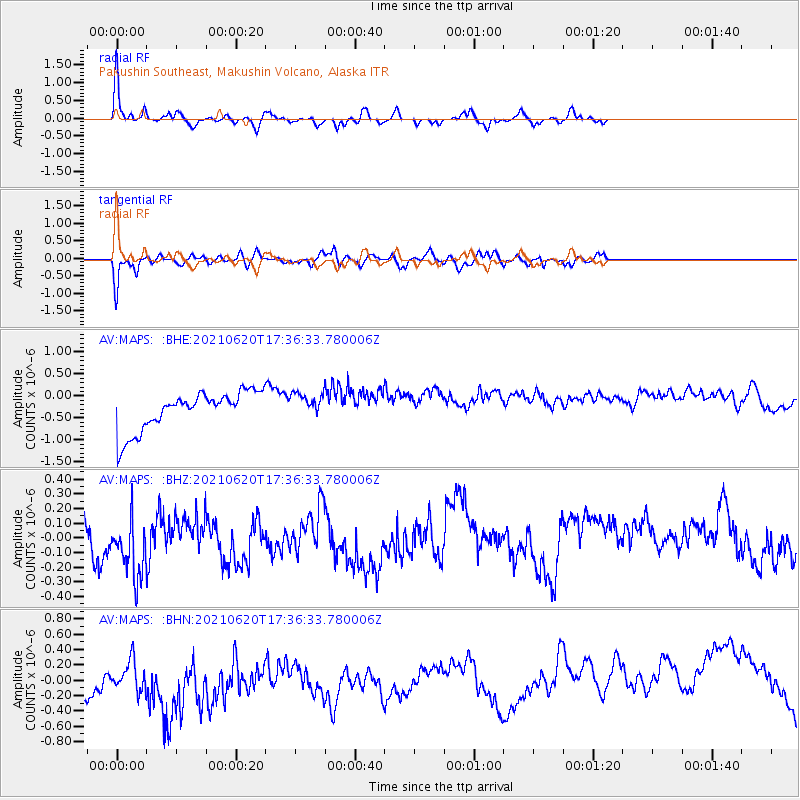
MAPS Pakushin Southeast, Makushin Volcano, Alaska - Earthquake Result Viewer
*The percent match for this event was below the threshold and hence no stack was calculated.
| Earthquake location: |
Kermadec Islands, New Zealand |
| Earthquake latitude/longitude: |
-30.1/-177.6 |
| Earthquake time(UTC): |
2021/06/20 (171) 17:24:34 GMT |
| Earthquake Depth: |
10 km |
| Earthquake Magnitude: |
5.5 Mww |
| Earthquake Catalog/Contributor: |
NEIC PDE/us |
|
| Network: |
AV Alaska Volcano Observatory |
| Station: |
MAPS Pakushin Southeast, Makushin Volcano, Alaska |
| Lat/Lon: |
53.81 N/166.94 W |
| Elevation: |
333 m |
|
| Distance: |
84.1 deg |
| Az: |
6.344 deg |
| Baz: |
189.29 deg |
| Ray Param: |
$rayparam |
*The percent match for this event was below the threshold and hence was not used in the summary stack. |
|
| Radial Match: |
64.679085 % |
| Radial Bump: |
251 |
| Transverse Match: |
71.79215 % |
| Transverse Bump: |
346 |
| SOD ConfigId: |
25131211 |
| Insert Time: |
2021-07-04 17:37:28.774 +0000 |
| GWidth: |
2.5 |
| Max Bumps: |
400 |
| Tol: |
0.001 |
|
Signal To Noise
| Channel | StoN | STA | LTA |
| AV:MAPS: :BHZ:20210620T17:36:33.780006Z | 1.0146042 | 3.1020014E-7 | 3.0573509E-7 |
| AV:MAPS: :BHN:20210620T17:36:33.780006Z | 0.5779073 | 4.8567904E-7 | 8.404099E-7 |
| AV:MAPS: :BHE:20210620T17:36:33.780006Z | 0.6515807 | 2.8869536E-7 | 4.4306924E-7 |
| Arrivals |
| Ps | |
| PpPs | |
| PsPs/PpSs | |


