You are here: Home > Network List > IU - Global Seismograph Network (GSN - IRIS/USGS) Stations List
> Station CCM Cathedral Cave, Missouri, USA > Earthquake Result Viewer
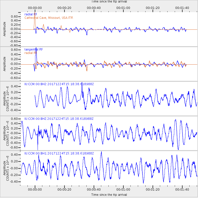
CCM Cathedral Cave, Missouri, USA - Earthquake Result Viewer
*The percent match for this event was below the threshold and hence no stack was calculated.
| Earthquake location: |
Leeward Islands |
| Earthquake latitude/longitude: |
18.3/-62.7 |
| Earthquake time(UTC): |
2017/12/24 (358) 15:12:51 GMT |
| Earthquake Depth: |
63 km |
| Earthquake Magnitude: |
5.5 Mi |
| Earthquake Catalog/Contributor: |
NEIC PDE/pt |
|
| Network: |
IU Global Seismograph Network (GSN - IRIS/USGS) |
| Station: |
CCM Cathedral Cave, Missouri, USA |
| Lat/Lon: |
38.06 N/91.24 W |
| Elevation: |
222 m |
|
| Distance: |
31.7 deg |
| Az: |
314.18 deg |
| Baz: |
120.347 deg |
| Ray Param: |
$rayparam |
*The percent match for this event was below the threshold and hence was not used in the summary stack. |
|
| Radial Match: |
59.283722 % |
| Radial Bump: |
400 |
| Transverse Match: |
65.00546 % |
| Transverse Bump: |
400 |
| SOD ConfigId: |
2429771 |
| Insert Time: |
2018-01-07 15:14:09.805 +0000 |
| GWidth: |
2.5 |
| Max Bumps: |
400 |
| Tol: |
0.001 |
|
Signal To Noise
| Channel | StoN | STA | LTA |
| IU:CCM:00:BHZ:20171224T15:18:38.618988Z | 0.6148163 | 1.521357E-7 | 2.47449E-7 |
| IU:CCM:00:BH1:20171224T15:18:38.618988Z | 1.4255592 | 2.1031319E-7 | 1.4753032E-7 |
| IU:CCM:00:BH2:20171224T15:18:38.618988Z | 1.0360372 | 1.9108721E-7 | 1.844405E-7 |
| Arrivals |
| Ps | |
| PpPs | |
| PsPs/PpSs | |


