You are here: Home > Network List > US - United States National Seismic Network Stations List
> Station AMTX Amarillo, Texas, USA > Earthquake Result Viewer
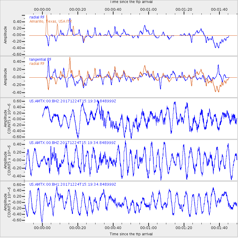
AMTX Amarillo, Texas, USA - Earthquake Result Viewer
*The percent match for this event was below the threshold and hence no stack was calculated.
| Earthquake location: |
Leeward Islands |
| Earthquake latitude/longitude: |
18.3/-62.7 |
| Earthquake time(UTC): |
2017/12/24 (358) 15:12:51 GMT |
| Earthquake Depth: |
63 km |
| Earthquake Magnitude: |
5.5 Mi |
| Earthquake Catalog/Contributor: |
NEIC PDE/pt |
|
| Network: |
US United States National Seismic Network |
| Station: |
AMTX Amarillo, Texas, USA |
| Lat/Lon: |
34.53 N/101.41 W |
| Elevation: |
1010 m |
|
| Distance: |
38.0 deg |
| Az: |
302.96 deg |
| Baz: |
105.112 deg |
| Ray Param: |
$rayparam |
*The percent match for this event was below the threshold and hence was not used in the summary stack. |
|
| Radial Match: |
38.34522 % |
| Radial Bump: |
400 |
| Transverse Match: |
46.04847 % |
| Transverse Bump: |
400 |
| SOD ConfigId: |
2429771 |
| Insert Time: |
2018-01-07 15:15:25.731 +0000 |
| GWidth: |
2.5 |
| Max Bumps: |
400 |
| Tol: |
0.001 |
|
Signal To Noise
| Channel | StoN | STA | LTA |
| US:AMTX:00:BHZ:20171224T15:19:34.848999Z | 0.6007015 | 1.2211196E-7 | 2.0328226E-7 |
| US:AMTX:00:BH1:20171224T15:19:34.848999Z | 1.7327228 | 2.917839E-7 | 1.6839618E-7 |
| US:AMTX:00:BH2:20171224T15:19:34.848999Z | 1.0127305 | 2.5144942E-7 | 2.4828861E-7 |
| Arrivals |
| Ps | |
| PpPs | |
| PsPs/PpSs | |


