You are here: Home > Network List > TA - USArray Transportable Network (new EarthScope stations) Stations List
> Station A36M Sachs Harbour, NT, CAN > Earthquake Result Viewer
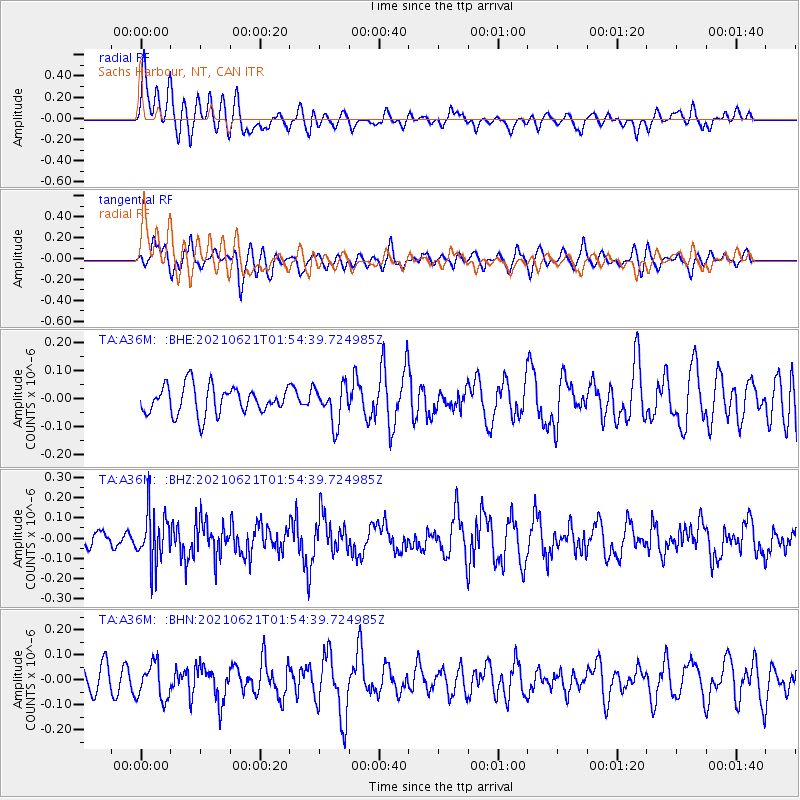
A36M Sachs Harbour, NT, CAN - Earthquake Result Viewer
*The percent match for this event was below the threshold and hence no stack was calculated.
| Earthquake location: |
Mariana Islands |
| Earthquake latitude/longitude: |
18.9/145.4 |
| Earthquake time(UTC): |
2021/06/21 (172) 01:44:11 GMT |
| Earthquake Depth: |
227 km |
| Earthquake Magnitude: |
5.5 mww |
| Earthquake Catalog/Contributor: |
NEIC PDE/us |
|
| Network: |
TA USArray Transportable Network (new EarthScope stations) |
| Station: |
A36M Sachs Harbour, NT, CAN |
| Lat/Lon: |
71.99 N/125.25 W |
| Elevation: |
32 m |
|
| Distance: |
72.0 deg |
| Az: |
19.094 deg |
| Baz: |
275.413 deg |
| Ray Param: |
$rayparam |
*The percent match for this event was below the threshold and hence was not used in the summary stack. |
|
| Radial Match: |
67.62596 % |
| Radial Bump: |
400 |
| Transverse Match: |
61.833714 % |
| Transverse Bump: |
400 |
| SOD ConfigId: |
25131211 |
| Insert Time: |
2021-07-05 01:55:24.442 +0000 |
| GWidth: |
2.5 |
| Max Bumps: |
400 |
| Tol: |
0.001 |
|
Signal To Noise
| Channel | StoN | STA | LTA |
| TA:A36M: :BHZ:20210621T01:54:39.724985Z | 2.6212718 | 1.2441595E-7 | 4.7463963E-8 |
| TA:A36M: :BHN:20210621T01:54:39.724985Z | 1.1019576 | 7.143509E-8 | 6.482562E-8 |
| TA:A36M: :BHE:20210621T01:54:39.724985Z | 1.3704557 | 6.730063E-8 | 4.9108216E-8 |
| Arrivals |
| Ps | |
| PpPs | |
| PsPs/PpSs | |


