You are here: Home > Network List > US - United States National Seismic Network Stations List
> Station AMTX Amarillo, Texas, USA > Earthquake Result Viewer
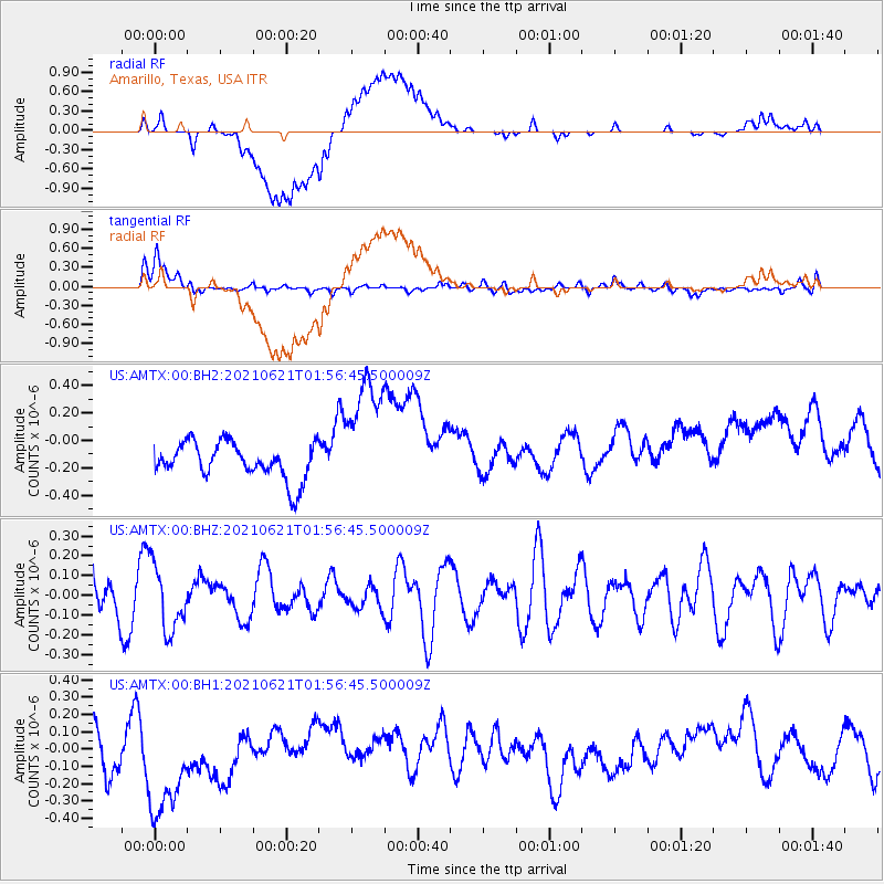
AMTX Amarillo, Texas, USA - Earthquake Result Viewer
*The percent match for this event was below the threshold and hence no stack was calculated.
| Earthquake location: |
Mariana Islands |
| Earthquake latitude/longitude: |
18.9/145.4 |
| Earthquake time(UTC): |
2021/06/21 (172) 01:44:11 GMT |
| Earthquake Depth: |
227 km |
| Earthquake Magnitude: |
5.5 mww |
| Earthquake Catalog/Contributor: |
NEIC PDE/us |
|
| Network: |
US United States National Seismic Network |
| Station: |
AMTX Amarillo, Texas, USA |
| Lat/Lon: |
34.53 N/101.41 W |
| Elevation: |
1010 m |
|
| Distance: |
97.2 deg |
| Az: |
49.913 deg |
| Baz: |
298.667 deg |
| Ray Param: |
$rayparam |
*The percent match for this event was below the threshold and hence was not used in the summary stack. |
|
| Radial Match: |
54.740646 % |
| Radial Bump: |
400 |
| Transverse Match: |
61.113487 % |
| Transverse Bump: |
400 |
| SOD ConfigId: |
25131211 |
| Insert Time: |
2021-07-05 01:56:33.279 +0000 |
| GWidth: |
2.5 |
| Max Bumps: |
400 |
| Tol: |
0.001 |
|
Signal To Noise
| Channel | StoN | STA | LTA |
| US:AMTX:00:BHZ:20210621T01:56:45.500009Z | 1.6062378 | 1.6202017E-7 | 1.0086936E-7 |
| US:AMTX:00:BH1:20210621T01:56:45.500009Z | 2.1873538 | 3.507527E-7 | 1.6035483E-7 |
| US:AMTX:00:BH2:20210621T01:56:45.500009Z | 3.7067652 | 4.9398625E-7 | 1.3326613E-7 |
| Arrivals |
| Ps | |
| PpPs | |
| PsPs/PpSs | |


