You are here: Home > Network List > GS - US Geological Survey Networks Stations List
> Station KAN13 Rinehart Farm > Earthquake Result Viewer
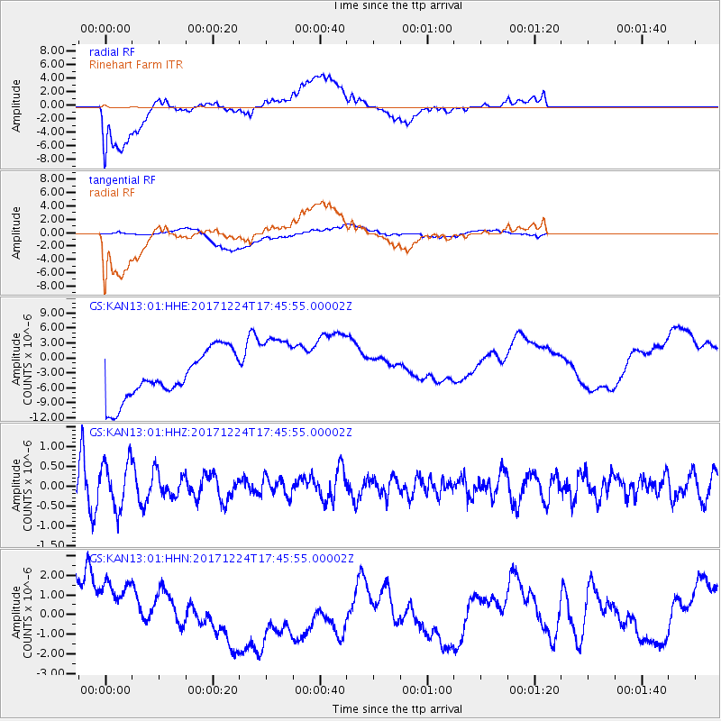
KAN13 Rinehart Farm - Earthquake Result Viewer
*The percent match for this event was below the threshold and hence no stack was calculated.
| Earthquake location: |
Samoa Islands Region |
| Earthquake latitude/longitude: |
-15.3/-172.9 |
| Earthquake time(UTC): |
2017/12/24 (358) 17:33:36 GMT |
| Earthquake Depth: |
10 km |
| Earthquake Magnitude: |
5.5 Mwb |
| Earthquake Catalog/Contributor: |
NEIC PDE/us |
|
| Network: |
GS US Geological Survey Networks |
| Station: |
KAN13 Rinehart Farm |
| Lat/Lon: |
37.01 N/97.48 W |
| Elevation: |
340 m |
|
| Distance: |
87.9 deg |
| Az: |
50.833 deg |
| Baz: |
249.146 deg |
| Ray Param: |
$rayparam |
*The percent match for this event was below the threshold and hence was not used in the summary stack. |
|
| Radial Match: |
22.178082 % |
| Radial Bump: |
400 |
| Transverse Match: |
47.91504 % |
| Transverse Bump: |
400 |
| SOD ConfigId: |
2429771 |
| Insert Time: |
2018-01-07 17:34:44.169 +0000 |
| GWidth: |
2.5 |
| Max Bumps: |
400 |
| Tol: |
0.001 |
|
Signal To Noise
| Channel | StoN | STA | LTA |
| GS:KAN13:01:HHZ:20171224T17:45:55.00002Z | 1.8835993 | 5.801477E-7 | 3.0799953E-7 |
| GS:KAN13:01:HHN:20171224T17:45:55.00002Z | 0.72999245 | 2.3167352E-6 | 3.1736427E-6 |
| GS:KAN13:01:HHE:20171224T17:45:55.00002Z | 1.5253648 | 7.1290037E-6 | 4.6736386E-6 |
| Arrivals |
| Ps | |
| PpPs | |
| PsPs/PpSs | |


