You are here: Home > Network List > CI - Caltech Regional Seismic Network Stations List
> Station MPP McPhearson Peak > Earthquake Result Viewer
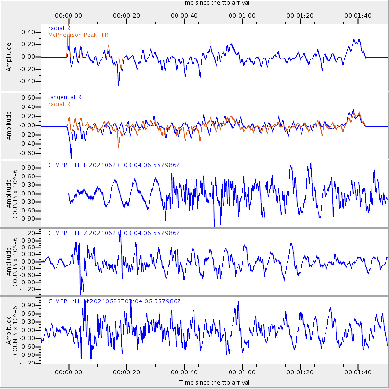
MPP McPhearson Peak - Earthquake Result Viewer
*The percent match for this event was below the threshold and hence no stack was calculated.
| Earthquake location: |
Near Coast Of Peru |
| Earthquake latitude/longitude: |
-12.7/-76.7 |
| Earthquake time(UTC): |
2021/06/23 (174) 02:54:18 GMT |
| Earthquake Depth: |
51 km |
| Earthquake Magnitude: |
5.8 mww |
| Earthquake Catalog/Contributor: |
NEIC PDE/us |
|
| Network: |
CI Caltech Regional Seismic Network |
| Station: |
MPP McPhearson Peak |
| Lat/Lon: |
34.89 N/119.81 W |
| Elevation: |
1739 m |
|
| Distance: |
62.5 deg |
| Az: |
320.721 deg |
| Baz: |
131.274 deg |
| Ray Param: |
$rayparam |
*The percent match for this event was below the threshold and hence was not used in the summary stack. |
|
| Radial Match: |
45.280766 % |
| Radial Bump: |
400 |
| Transverse Match: |
61.306774 % |
| Transverse Bump: |
400 |
| SOD ConfigId: |
25131211 |
| Insert Time: |
2021-07-07 03:00:48.239 +0000 |
| GWidth: |
2.5 |
| Max Bumps: |
400 |
| Tol: |
0.001 |
|
Signal To Noise
| Channel | StoN | STA | LTA |
| CI:MPP: :HHZ:20210623T03:04:06.557986Z | 3.084617 | 5.308003E-7 | 1.7207982E-7 |
| CI:MPP: :HHN:20210623T03:04:06.557986Z | 0.99297893 | 3.399253E-7 | 3.423288E-7 |
| CI:MPP: :HHE:20210623T03:04:06.557986Z | 1.5494274 | 3.823994E-7 | 2.4680048E-7 |
| Arrivals |
| Ps | |
| PpPs | |
| PsPs/PpSs | |


