You are here: Home > Network List > CN - Canadian National Seismograph Network Stations List
> Station INK INUVIK, NT > Earthquake Result Viewer
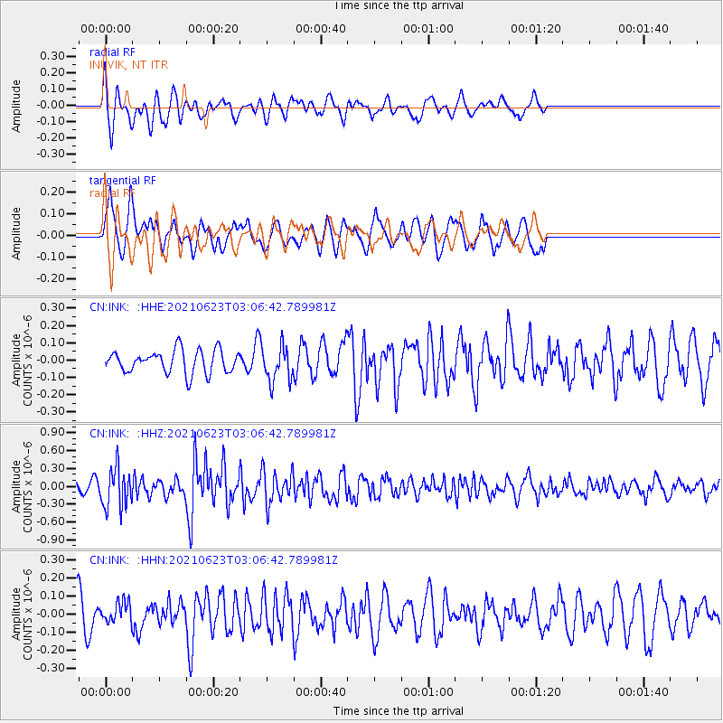
INK INUVIK, NT - Earthquake Result Viewer
*The percent match for this event was below the threshold and hence no stack was calculated.
| Earthquake location: |
Near Coast Of Peru |
| Earthquake latitude/longitude: |
-12.7/-76.7 |
| Earthquake time(UTC): |
2021/06/23 (174) 02:54:18 GMT |
| Earthquake Depth: |
51 km |
| Earthquake Magnitude: |
5.8 mww |
| Earthquake Catalog/Contributor: |
NEIC PDE/us |
|
| Network: |
CN Canadian National Seismograph Network |
| Station: |
INK INUVIK, NT |
| Lat/Lon: |
68.31 N/133.53 W |
| Elevation: |
44 m |
|
| Distance: |
90.2 deg |
| Az: |
341.873 deg |
| Baz: |
125.25 deg |
| Ray Param: |
$rayparam |
*The percent match for this event was below the threshold and hence was not used in the summary stack. |
|
| Radial Match: |
64.44509 % |
| Radial Bump: |
400 |
| Transverse Match: |
69.92684 % |
| Transverse Bump: |
400 |
| SOD ConfigId: |
25131211 |
| Insert Time: |
2021-07-07 03:02:11.138 +0000 |
| GWidth: |
2.5 |
| Max Bumps: |
400 |
| Tol: |
0.001 |
|
Signal To Noise
| Channel | StoN | STA | LTA |
| CN:INK: :HHZ:20210623T03:06:42.789981Z | 3.386611 | 3.4046866E-7 | 1.0053374E-7 |
| CN:INK: :HHN:20210623T03:06:42.789981Z | 1.0139812 | 5.7103332E-8 | 5.6315965E-8 |
| CN:INK: :HHE:20210623T03:06:42.789981Z | 1.5481123 | 1.01781204E-7 | 6.574537E-8 |
| Arrivals |
| Ps | |
| PpPs | |
| PsPs/PpSs | |


