You are here: Home > Network List > TA - USArray Transportable Network (new EarthScope stations) Stations List
> Station A36M Sachs Harbour, NT, CAN > Earthquake Result Viewer
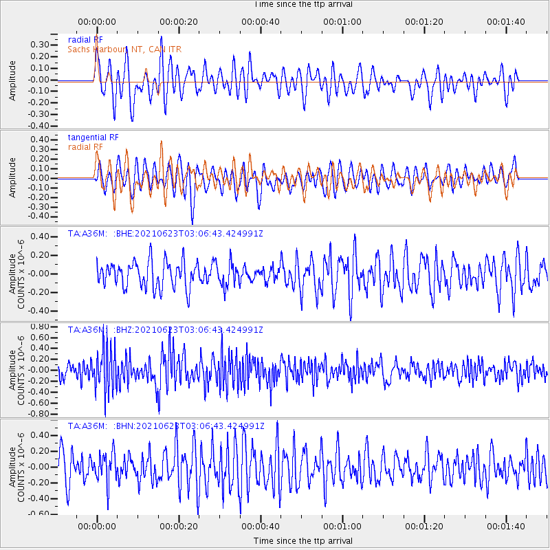
A36M Sachs Harbour, NT, CAN - Earthquake Result Viewer
*The percent match for this event was below the threshold and hence no stack was calculated.
| Earthquake location: |
Near Coast Of Peru |
| Earthquake latitude/longitude: |
-12.7/-76.7 |
| Earthquake time(UTC): |
2021/06/23 (174) 02:54:18 GMT |
| Earthquake Depth: |
51 km |
| Earthquake Magnitude: |
5.8 mww |
| Earthquake Catalog/Contributor: |
NEIC PDE/us |
|
| Network: |
TA USArray Transportable Network (new EarthScope stations) |
| Station: |
A36M Sachs Harbour, NT, CAN |
| Lat/Lon: |
71.99 N/125.25 W |
| Elevation: |
32 m |
|
| Distance: |
90.4 deg |
| Az: |
346.52 deg |
| Baz: |
133.012 deg |
| Ray Param: |
$rayparam |
*The percent match for this event was below the threshold and hence was not used in the summary stack. |
|
| Radial Match: |
60.64936 % |
| Radial Bump: |
400 |
| Transverse Match: |
59.56025 % |
| Transverse Bump: |
400 |
| SOD ConfigId: |
25131211 |
| Insert Time: |
2021-07-07 03:15:28.383 +0000 |
| GWidth: |
2.5 |
| Max Bumps: |
400 |
| Tol: |
0.001 |
|
Signal To Noise
| Channel | StoN | STA | LTA |
| TA:A36M: :BHZ:20210623T03:06:43.424991Z | 3.7027755 | 4.0440554E-7 | 1.0921687E-7 |
| TA:A36M: :BHN:20210623T03:06:43.424991Z | 1.1301079 | 1.8640603E-7 | 1.6494535E-7 |
| TA:A36M: :BHE:20210623T03:06:43.424991Z | 0.9018788 | 1.2514936E-7 | 1.3876516E-7 |
| Arrivals |
| Ps | |
| PpPs | |
| PsPs/PpSs | |


