You are here: Home > Network List > US - United States National Seismic Network Stations List
> Station EGMT Eagleton, Montana, USA > Earthquake Result Viewer
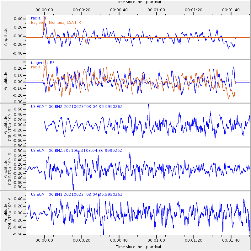
EGMT Eagleton, Montana, USA - Earthquake Result Viewer
*The percent match for this event was below the threshold and hence no stack was calculated.
| Earthquake location: |
Near Coast Of Peru |
| Earthquake latitude/longitude: |
-12.7/-76.7 |
| Earthquake time(UTC): |
2021/06/23 (174) 02:54:18 GMT |
| Earthquake Depth: |
51 km |
| Earthquake Magnitude: |
5.8 mww |
| Earthquake Catalog/Contributor: |
NEIC PDE/us |
|
| Network: |
US United States National Seismic Network |
| Station: |
EGMT Eagleton, Montana, USA |
| Lat/Lon: |
48.02 N/109.75 W |
| Elevation: |
1055 m |
|
| Distance: |
67.2 deg |
| Az: |
336.612 deg |
| Baz: |
144.755 deg |
| Ray Param: |
$rayparam |
*The percent match for this event was below the threshold and hence was not used in the summary stack. |
|
| Radial Match: |
57.392105 % |
| Radial Bump: |
400 |
| Transverse Match: |
55.853077 % |
| Transverse Bump: |
400 |
| SOD ConfigId: |
25131211 |
| Insert Time: |
2021-07-07 03:18:16.544 +0000 |
| GWidth: |
2.5 |
| Max Bumps: |
400 |
| Tol: |
0.001 |
|
Signal To Noise
| Channel | StoN | STA | LTA |
| US:EGMT:00:BHZ:20210623T03:04:36.999026Z | 3.52979 | 2.7665195E-7 | 7.8376324E-8 |
| US:EGMT:00:BH1:20210623T03:04:36.999026Z | 1.1323504 | 1.2959909E-7 | 1.1445139E-7 |
| US:EGMT:00:BH2:20210623T03:04:36.999026Z | 1.2953826 | 1.9883453E-7 | 1.5349482E-7 |
| Arrivals |
| Ps | |
| PpPs | |
| PsPs/PpSs | |


