You are here: Home > Network List > UW - Pacific Northwest Regional Seismic Network Stations List
> Station UMAT Pilot Rock, OR, USA > Earthquake Result Viewer
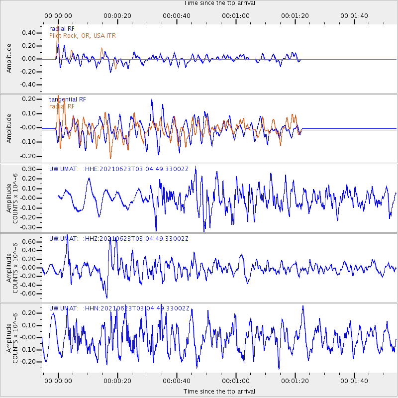
UMAT Pilot Rock, OR, USA - Earthquake Result Viewer
*The percent match for this event was below the threshold and hence no stack was calculated.
| Earthquake location: |
Near Coast Of Peru |
| Earthquake latitude/longitude: |
-12.7/-76.7 |
| Earthquake time(UTC): |
2021/06/23 (174) 02:54:18 GMT |
| Earthquake Depth: |
51 km |
| Earthquake Magnitude: |
5.8 mww |
| Earthquake Catalog/Contributor: |
NEIC PDE/us |
|
| Network: |
UW Pacific Northwest Regional Seismic Network |
| Station: |
UMAT Pilot Rock, OR, USA |
| Lat/Lon: |
45.29 N/118.96 W |
| Elevation: |
1318 m |
|
| Distance: |
69.2 deg |
| Az: |
329.491 deg |
| Baz: |
135.424 deg |
| Ray Param: |
$rayparam |
*The percent match for this event was below the threshold and hence was not used in the summary stack. |
|
| Radial Match: |
55.93963 % |
| Radial Bump: |
400 |
| Transverse Match: |
52.835403 % |
| Transverse Bump: |
400 |
| SOD ConfigId: |
25131211 |
| Insert Time: |
2021-07-07 03:20:49.902 +0000 |
| GWidth: |
2.5 |
| Max Bumps: |
400 |
| Tol: |
0.001 |
|
Signal To Noise
| Channel | StoN | STA | LTA |
| UW:UMAT: :HHZ:20210623T03:04:49.33002Z | 3.2468393 | 2.6398286E-7 | 8.130456E-8 |
| UW:UMAT: :HHN:20210623T03:04:49.33002Z | 1.6028106 | 1.0866421E-7 | 6.779604E-8 |
| UW:UMAT: :HHE:20210623T03:04:49.33002Z | 1.3539019 | 1.1421729E-7 | 8.4361574E-8 |
| Arrivals |
| Ps | |
| PpPs | |
| PsPs/PpSs | |


