You are here: Home > Network List > UW - Pacific Northwest Regional Seismic Network Stations List
> Station IRON Crane, OR, USA > Earthquake Result Viewer
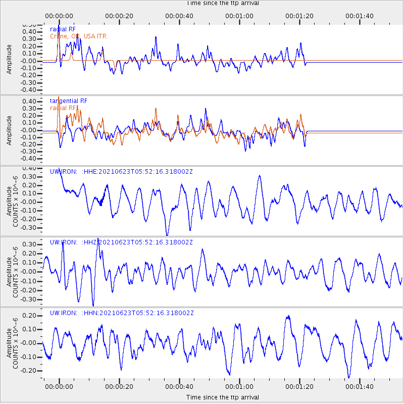
IRON Crane, OR, USA - Earthquake Result Viewer
*The percent match for this event was below the threshold and hence no stack was calculated.
| Earthquake location: |
Southeast Of Loyalty Islands |
| Earthquake latitude/longitude: |
-22.8/171.7 |
| Earthquake time(UTC): |
2021/06/23 (174) 05:39:39 GMT |
| Earthquake Depth: |
10 km |
| Earthquake Magnitude: |
5.5 mb |
| Earthquake Catalog/Contributor: |
NEIC PDE/us |
|
| Network: |
UW Pacific Northwest Regional Seismic Network |
| Station: |
IRON Crane, OR, USA |
| Lat/Lon: |
43.36 N/118.47 W |
| Elevation: |
1226 m |
|
| Distance: |
91.8 deg |
| Az: |
43.243 deg |
| Baz: |
240.084 deg |
| Ray Param: |
$rayparam |
*The percent match for this event was below the threshold and hence was not used in the summary stack. |
|
| Radial Match: |
47.17108 % |
| Radial Bump: |
400 |
| Transverse Match: |
58.342278 % |
| Transverse Bump: |
356 |
| SOD ConfigId: |
25131211 |
| Insert Time: |
2021-07-07 05:52:49.887 +0000 |
| GWidth: |
2.5 |
| Max Bumps: |
400 |
| Tol: |
0.001 |
|
Signal To Noise
| Channel | StoN | STA | LTA |
| UW:IRON: :HHZ:20210623T05:52:16.318002Z | 1.1009171 | 1.2495104E-7 | 1.1349724E-7 |
| UW:IRON: :HHN:20210623T05:52:16.318002Z | 0.760058 | 4.8584244E-8 | 6.392176E-8 |
| UW:IRON: :HHE:20210623T05:52:16.318002Z | 1.0549438 | 1.2815394E-7 | 1.214794E-7 |
| Arrivals |
| Ps | |
| PpPs | |
| PsPs/PpSs | |


