You are here: Home > Network List > AZ - ANZA Regional Network Stations List
> Station SMER AZ.SMER > Earthquake Result Viewer
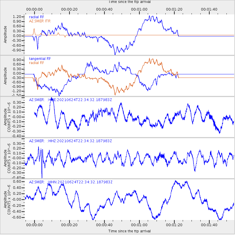
SMER AZ.SMER - Earthquake Result Viewer
*The percent match for this event was below the threshold and hence no stack was calculated.
| Earthquake location: |
South Of Kermadec Islands |
| Earthquake latitude/longitude: |
-34.7/179.2 |
| Earthquake time(UTC): |
2021/06/24 (175) 22:22:02 GMT |
| Earthquake Depth: |
10 km |
| Earthquake Magnitude: |
5.5 mb |
| Earthquake Catalog/Contributor: |
NEIC PDE/us |
|
| Network: |
AZ ANZA Regional Network |
| Station: |
SMER AZ.SMER |
| Lat/Lon: |
33.46 N/117.17 W |
| Elevation: |
355 m |
|
| Distance: |
90.3 deg |
| Az: |
48.499 deg |
| Baz: |
227.578 deg |
| Ray Param: |
$rayparam |
*The percent match for this event was below the threshold and hence was not used in the summary stack. |
|
| Radial Match: |
44.96842 % |
| Radial Bump: |
400 |
| Transverse Match: |
47.059746 % |
| Transverse Bump: |
400 |
| SOD ConfigId: |
25131211 |
| Insert Time: |
2021-07-08 22:23:57.404 +0000 |
| GWidth: |
2.5 |
| Max Bumps: |
400 |
| Tol: |
0.001 |
|
Signal To Noise
| Channel | StoN | STA | LTA |
| AZ:SMER: :HHZ:20210624T22:34:32.187983Z | 1.2354962 | 1.246198E-7 | 1.008662E-7 |
| AZ:SMER: :HHN:20210624T22:34:32.187983Z | 2.1144893 | 4.8334124E-7 | 2.2858534E-7 |
| AZ:SMER: :HHE:20210624T22:34:32.187983Z | 0.52349085 | 8.858483E-8 | 1.6921943E-7 |
| Arrivals |
| Ps | |
| PpPs | |
| PsPs/PpSs | |


