You are here: Home > Network List > CI - Caltech Regional Seismic Network Stations List
> Station MPP McPhearson Peak > Earthquake Result Viewer
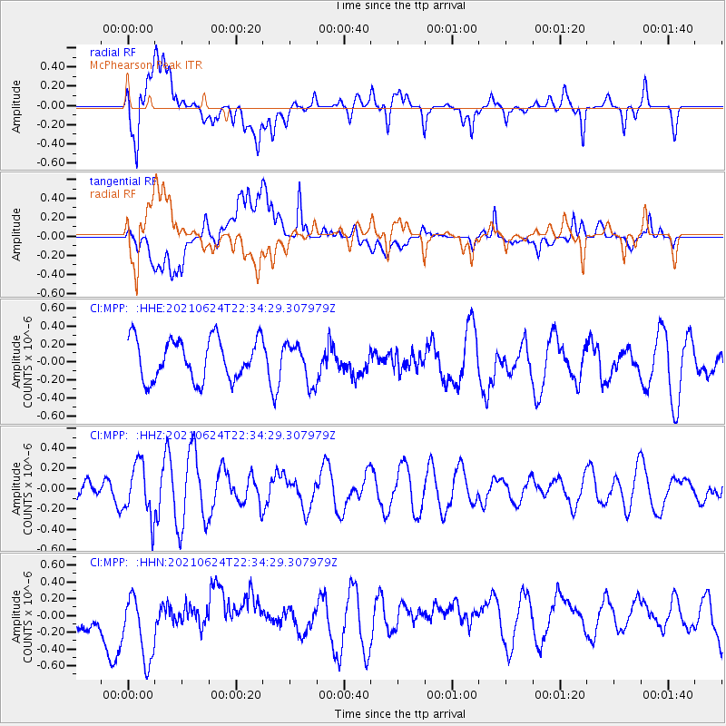
MPP McPhearson Peak - Earthquake Result Viewer
*The percent match for this event was below the threshold and hence no stack was calculated.
| Earthquake location: |
South Of Kermadec Islands |
| Earthquake latitude/longitude: |
-34.7/179.2 |
| Earthquake time(UTC): |
2021/06/24 (175) 22:22:02 GMT |
| Earthquake Depth: |
10 km |
| Earthquake Magnitude: |
5.5 mb |
| Earthquake Catalog/Contributor: |
NEIC PDE/us |
|
| Network: |
CI Caltech Regional Seismic Network |
| Station: |
MPP McPhearson Peak |
| Lat/Lon: |
34.89 N/119.81 W |
| Elevation: |
1739 m |
|
| Distance: |
89.7 deg |
| Az: |
45.959 deg |
| Baz: |
226.098 deg |
| Ray Param: |
$rayparam |
*The percent match for this event was below the threshold and hence was not used in the summary stack. |
|
| Radial Match: |
63.329124 % |
| Radial Bump: |
400 |
| Transverse Match: |
54.01215 % |
| Transverse Bump: |
400 |
| SOD ConfigId: |
25131211 |
| Insert Time: |
2021-07-08 22:26:10.698 +0000 |
| GWidth: |
2.5 |
| Max Bumps: |
400 |
| Tol: |
0.001 |
|
Signal To Noise
| Channel | StoN | STA | LTA |
| CI:MPP: :HHZ:20210624T22:34:29.307979Z | 2.6852481 | 2.648704E-7 | 9.863908E-8 |
| CI:MPP: :HHN:20210624T22:34:29.307979Z | 2.072641 | 4.297074E-7 | 2.0732362E-7 |
| CI:MPP: :HHE:20210624T22:34:29.307979Z | 0.9690339 | 2.2035262E-7 | 2.2739412E-7 |
| Arrivals |
| Ps | |
| PpPs | |
| PsPs/PpSs | |


