You are here: Home > Network List > UW - Pacific Northwest Regional Seismic Network Stations List
> Station IRON Crane, OR, USA > Earthquake Result Viewer
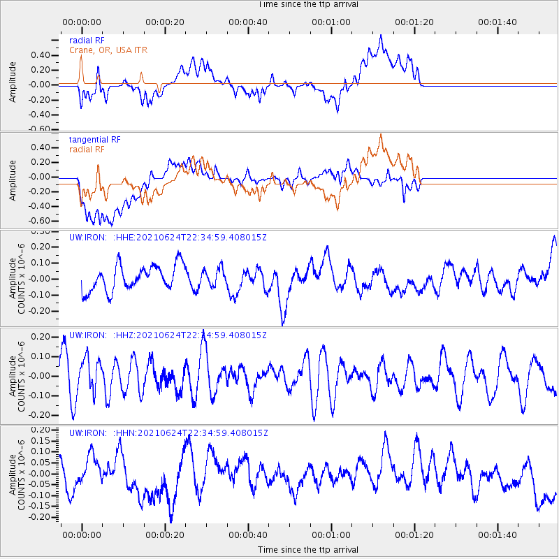
IRON Crane, OR, USA - Earthquake Result Viewer
*The percent match for this event was below the threshold and hence no stack was calculated.
| Earthquake location: |
South Of Kermadec Islands |
| Earthquake latitude/longitude: |
-34.7/179.2 |
| Earthquake time(UTC): |
2021/06/24 (175) 22:22:02 GMT |
| Earthquake Depth: |
10 km |
| Earthquake Magnitude: |
5.5 mb |
| Earthquake Catalog/Contributor: |
NEIC PDE/us |
|
| Network: |
UW Pacific Northwest Regional Seismic Network |
| Station: |
IRON Crane, OR, USA |
| Lat/Lon: |
43.36 N/118.47 W |
| Elevation: |
1226 m |
|
| Distance: |
96.2 deg |
| Az: |
40.52 deg |
| Baz: |
227.222 deg |
| Ray Param: |
$rayparam |
*The percent match for this event was below the threshold and hence was not used in the summary stack. |
|
| Radial Match: |
60.272305 % |
| Radial Bump: |
400 |
| Transverse Match: |
43.106922 % |
| Transverse Bump: |
400 |
| SOD ConfigId: |
25131211 |
| Insert Time: |
2021-07-08 22:31:22.800 +0000 |
| GWidth: |
2.5 |
| Max Bumps: |
400 |
| Tol: |
0.001 |
|
Signal To Noise
| Channel | StoN | STA | LTA |
| UW:IRON: :HHZ:20210624T22:34:59.408015Z | 1.1657052 | 8.382986E-8 | 7.191343E-8 |
| UW:IRON: :HHN:20210624T22:34:59.408015Z | 1.0182798 | 7.415083E-8 | 7.28197E-8 |
| UW:IRON: :HHE:20210624T22:34:59.408015Z | 0.6629625 | 5.25835E-8 | 7.9315946E-8 |
| Arrivals |
| Ps | |
| PpPs | |
| PsPs/PpSs | |


