You are here: Home > Network List > IW - Intermountain West Stations List
> Station PLID Pearl Lake, Idaho, USA > Earthquake Result Viewer
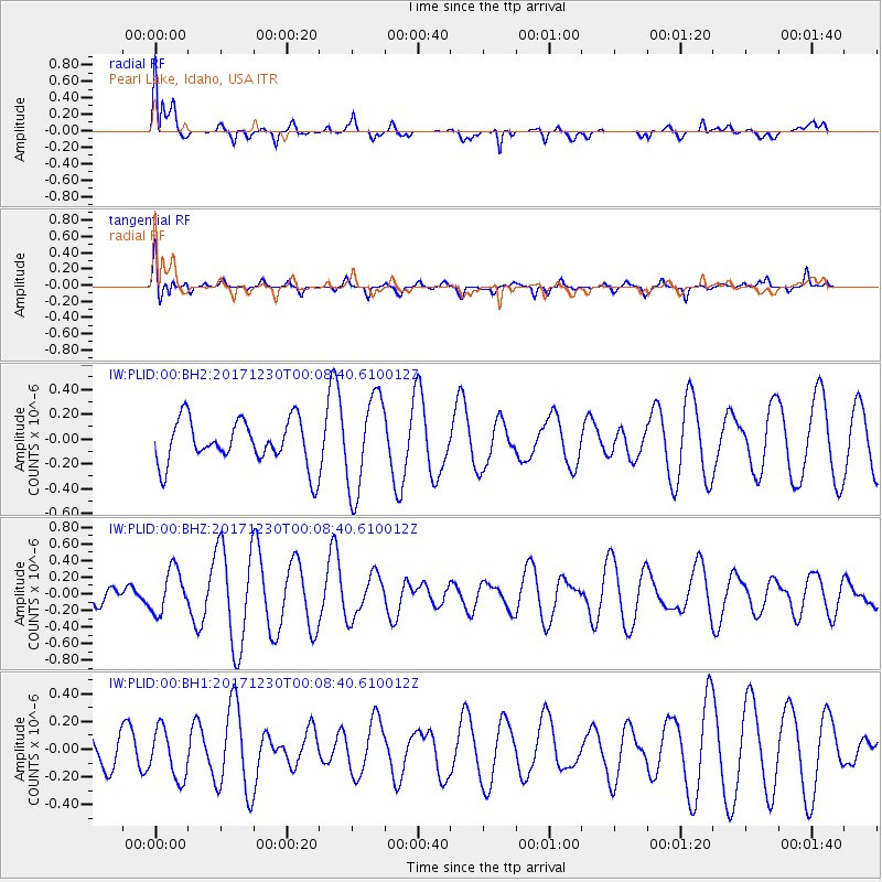
PLID Pearl Lake, Idaho, USA - Earthquake Result Viewer
*The percent match for this event was below the threshold and hence no stack was calculated.
| Earthquake location: |
New Britain Region, P.N.G. |
| Earthquake latitude/longitude: |
-5.4/150.8 |
| Earthquake time(UTC): |
2017/12/29 (363) 23:55:54 GMT |
| Earthquake Depth: |
90 km |
| Earthquake Magnitude: |
5.7 Mww |
| Earthquake Catalog/Contributor: |
NEIC PDE/us |
|
| Network: |
IW Intermountain West |
| Station: |
PLID Pearl Lake, Idaho, USA |
| Lat/Lon: |
45.09 N/116.00 W |
| Elevation: |
2164 m |
|
| Distance: |
96.0 deg |
| Az: |
45.339 deg |
| Baz: |
268.383 deg |
| Ray Param: |
$rayparam |
*The percent match for this event was below the threshold and hence was not used in the summary stack. |
|
| Radial Match: |
69.45839 % |
| Radial Bump: |
400 |
| Transverse Match: |
52.56802 % |
| Transverse Bump: |
349 |
| SOD ConfigId: |
2528331 |
| Insert Time: |
2018-01-12 23:57:19.766 +0000 |
| GWidth: |
2.5 |
| Max Bumps: |
400 |
| Tol: |
0.001 |
|
Signal To Noise
| Channel | StoN | STA | LTA |
| IW:PLID:00:BHZ:20171230T00:08:40.610012Z | 1.9849743 | 2.5939002E-7 | 1.3067677E-7 |
| IW:PLID:00:BH1:20171230T00:08:40.610012Z | 0.81740636 | 1.7968013E-7 | 2.1981737E-7 |
| IW:PLID:00:BH2:20171230T00:08:40.610012Z | 2.1178713 | 3.8404588E-7 | 1.813358E-7 |
| Arrivals |
| Ps | |
| PpPs | |
| PsPs/PpSs | |


