You are here: Home > Network List > CI - Caltech Regional Seismic Network Stations List
> Station MPP McPhearson Peak > Earthquake Result Viewer
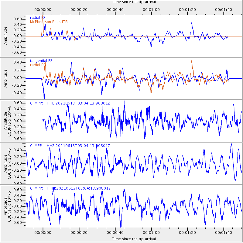
MPP McPhearson Peak - Earthquake Result Viewer
*The percent match for this event was below the threshold and hence no stack was calculated.
| Earthquake location: |
Guatemala |
| Earthquake latitude/longitude: |
14.0/-91.5 |
| Earthquake time(UTC): |
2021/06/13 (164) 02:58:15 GMT |
| Earthquake Depth: |
63 km |
| Earthquake Magnitude: |
5.5 mww |
| Earthquake Catalog/Contributor: |
NEIC PDE/us |
|
| Network: |
CI Caltech Regional Seismic Network |
| Station: |
MPP McPhearson Peak |
| Lat/Lon: |
34.89 N/119.81 W |
| Elevation: |
1739 m |
|
| Distance: |
32.9 deg |
| Az: |
314.082 deg |
| Baz: |
122.002 deg |
| Ray Param: |
$rayparam |
*The percent match for this event was below the threshold and hence was not used in the summary stack. |
|
| Radial Match: |
50.919876 % |
| Radial Bump: |
400 |
| Transverse Match: |
52.626816 % |
| Transverse Bump: |
379 |
| SOD ConfigId: |
25131211 |
| Insert Time: |
2021-07-09 23:26:29.378 +0000 |
| GWidth: |
2.5 |
| Max Bumps: |
400 |
| Tol: |
0.001 |
|
Signal To Noise
| Channel | StoN | STA | LTA |
| CI:MPP: :HHZ:20210613T03:04:13.90801Z | 1.3349957 | 2.1526702E-7 | 1.6124922E-7 |
| CI:MPP: :HHN:20210613T03:04:13.90801Z | 1.3221483 | 3.0843773E-7 | 2.3328526E-7 |
| CI:MPP: :HHE:20210613T03:04:13.90801Z | 0.6833986 | 1.3389881E-7 | 1.9593077E-7 |
| Arrivals |
| Ps | |
| PpPs | |
| PsPs/PpSs | |


