You are here: Home > Network List > US - United States National Seismic Network Stations List
> Station AMTX Amarillo, Texas, USA > Earthquake Result Viewer
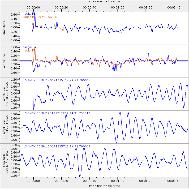
AMTX Amarillo, Texas, USA - Earthquake Result Viewer
*The percent match for this event was below the threshold and hence no stack was calculated.
| Earthquake location: |
Tonga Islands |
| Earthquake latitude/longitude: |
-21.9/-174.4 |
| Earthquake time(UTC): |
2017/12/15 (349) 12:12:07 GMT |
| Earthquake Depth: |
10 km |
| Earthquake Magnitude: |
5.3 Mww |
| Earthquake Catalog/Contributor: |
NEIC PDE/us |
|
| Network: |
US United States National Seismic Network |
| Station: |
AMTX Amarillo, Texas, USA |
| Lat/Lon: |
34.53 N/101.41 W |
| Elevation: |
1010 m |
|
| Distance: |
89.1 deg |
| Az: |
52.149 deg |
| Baz: |
242.675 deg |
| Ray Param: |
$rayparam |
*The percent match for this event was below the threshold and hence was not used in the summary stack. |
|
| Radial Match: |
65.21793 % |
| Radial Bump: |
400 |
| Transverse Match: |
59.796333 % |
| Transverse Bump: |
400 |
| SOD ConfigId: |
2528331 |
| Insert Time: |
2018-01-14 07:41:16.637 +0000 |
| GWidth: |
2.5 |
| Max Bumps: |
400 |
| Tol: |
0.001 |
|
Signal To Noise
| Channel | StoN | STA | LTA |
| US:AMTX:00:BHZ:20171215T12:24:31.70001Z | 0.7577109 | 2.7067472E-7 | 3.5722692E-7 |
| US:AMTX:00:BH1:20171215T12:24:31.70001Z | 0.59803146 | 2.782378E-7 | 4.652561E-7 |
| US:AMTX:00:BH2:20171215T12:24:31.70001Z | 1.2847635 | 5.3077764E-7 | 4.1313257E-7 |
| Arrivals |
| Ps | |
| PpPs | |
| PsPs/PpSs | |


