You are here: Home > Network List > UW - Pacific Northwest Regional Seismic Network Stations List
> Station HOOD Mt Hood Meadows, OR CREST BB SMO > Earthquake Result Viewer
HOOD Mt Hood Meadows, OR CREST BB SMO - Earthquake Result Viewer
*The percent match for this event was below the threshold and hence no stack was calculated.
| Earthquake location: |
Guatemala |
| Earthquake latitude/longitude: |
14.0/-91.5 |
| Earthquake time(UTC): |
2021/06/13 (164) 02:58:15 GMT |
| Earthquake Depth: |
63 km |
| Earthquake Magnitude: |
5.5 mww |
| Earthquake Catalog/Contributor: |
NEIC PDE/us |
|
| Network: |
UW Pacific Northwest Regional Seismic Network |
| Station: |
HOOD Mt Hood Meadows, OR CREST BB SMO |
| Lat/Lon: |
45.32 N/121.65 W |
| Elevation: |
1520 m |
|
| Distance: |
40.3 deg |
| Az: |
326.727 deg |
| Baz: |
131.002 deg |
| Ray Param: |
$rayparam |
*The percent match for this event was below the threshold and hence was not used in the summary stack. |
|
| Radial Match: |
69.28726 % |
| Radial Bump: |
400 |
| Transverse Match: |
72.55771 % |
| Transverse Bump: |
400 |
| SOD ConfigId: |
25131211 |
| Insert Time: |
2021-07-09 23:34:14.099 +0000 |
| GWidth: |
2.5 |
| Max Bumps: |
400 |
| Tol: |
0.001 |
|
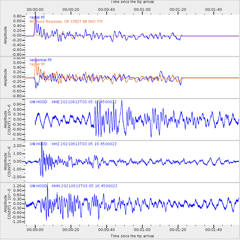
Signal To Noise
| Channel | StoN | STA | LTA |
| UW:HOOD: :HHZ:20210613T03:05:16.450002Z | 5.455592 | 8.584033E-7 | 1.5734376E-7 |
| UW:HOOD: :HHN:20210613T03:05:16.450002Z | 1.1344026 | 2.1146222E-7 | 1.8640844E-7 |
| UW:HOOD: :HHE:20210613T03:05:16.450002Z | 2.0736804 | 4.2432103E-7 | 2.046222E-7 |
| Arrivals |
| Ps | |
| PpPs | |
| PsPs/PpSs | |


