You are here: Home > Network List > BK - Berkeley Digital Seismograph Network Stations List
> Station HUMO Hull Mountain, OR > Earthquake Result Viewer
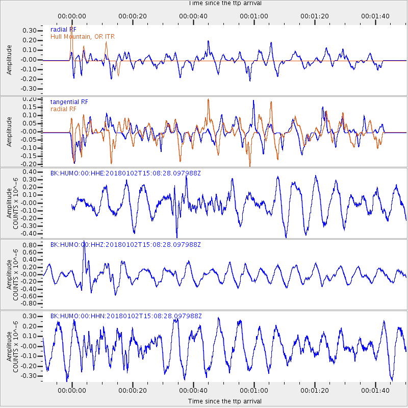
HUMO Hull Mountain, OR - Earthquake Result Viewer
*The percent match for this event was below the threshold and hence no stack was calculated.
| Earthquake location: |
South Of Fiji Islands |
| Earthquake latitude/longitude: |
-24.8/178.5 |
| Earthquake time(UTC): |
2018/01/02 (002) 14:57:18 GMT |
| Earthquake Depth: |
577 km |
| Earthquake Magnitude: |
5.9 Mww |
| Earthquake Catalog/Contributor: |
NEIC PDE/us |
|
| Network: |
BK Berkeley Digital Seismograph Network |
| Station: |
HUMO Hull Mountain, OR |
| Lat/Lon: |
42.61 N/122.96 W |
| Elevation: |
555 m |
|
| Distance: |
86.1 deg |
| Az: |
39.161 deg |
| Baz: |
231.011 deg |
| Ray Param: |
$rayparam |
*The percent match for this event was below the threshold and hence was not used in the summary stack. |
|
| Radial Match: |
60.816494 % |
| Radial Bump: |
400 |
| Transverse Match: |
39.61616 % |
| Transverse Bump: |
286 |
| SOD ConfigId: |
2528331 |
| Insert Time: |
2018-01-16 14:57:49.137 +0000 |
| GWidth: |
2.5 |
| Max Bumps: |
400 |
| Tol: |
0.001 |
|
Signal To Noise
| Channel | StoN | STA | LTA |
| BK:HUMO:00:HHZ:20180102T15:08:28.097988Z | 2.3219583 | 3.3699618E-7 | 1.4513446E-7 |
| BK:HUMO:00:HHN:20180102T15:08:28.097988Z | 0.82408655 | 1.4673472E-7 | 1.7805742E-7 |
| BK:HUMO:00:HHE:20180102T15:08:28.097988Z | 1.015425 | 1.4283457E-7 | 1.4066481E-7 |
| Arrivals |
| Ps | |
| PpPs | |
| PsPs/PpSs | |


