You are here: Home > Network List > IU - Global Seismograph Network (GSN - IRIS/USGS) Stations List
> Station XMAS Kiritimati Island, Republic of Kiribati > Earthquake Result Viewer
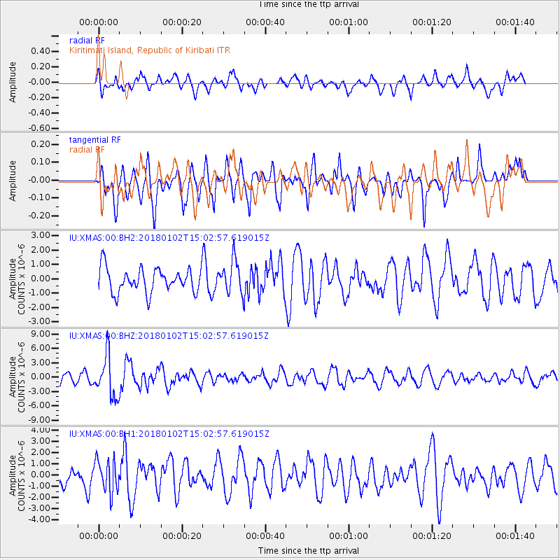
XMAS Kiritimati Island, Republic of Kiribati - Earthquake Result Viewer
*The percent match for this event was below the threshold and hence no stack was calculated.
| Earthquake location: |
South Of Fiji Islands |
| Earthquake latitude/longitude: |
-24.8/178.5 |
| Earthquake time(UTC): |
2018/01/02 (002) 14:57:18 GMT |
| Earthquake Depth: |
577 km |
| Earthquake Magnitude: |
5.9 Mww |
| Earthquake Catalog/Contributor: |
NEIC PDE/us |
|
| Network: |
IU Global Seismograph Network (GSN - IRIS/USGS) |
| Station: |
XMAS Kiritimati Island, Republic of Kiribati |
| Lat/Lon: |
2.04 N/157.45 W |
| Elevation: |
20 m |
|
| Distance: |
35.5 deg |
| Az: |
44.643 deg |
| Baz: |
219.712 deg |
| Ray Param: |
$rayparam |
*The percent match for this event was below the threshold and hence was not used in the summary stack. |
|
| Radial Match: |
54.479904 % |
| Radial Bump: |
400 |
| Transverse Match: |
58.734688 % |
| Transverse Bump: |
400 |
| SOD ConfigId: |
2528331 |
| Insert Time: |
2018-01-16 14:58:55.367 +0000 |
| GWidth: |
2.5 |
| Max Bumps: |
400 |
| Tol: |
0.001 |
|
Signal To Noise
| Channel | StoN | STA | LTA |
| IU:XMAS:00:BHZ:20180102T15:02:57.619015Z | 3.7155294 | 4.4304174E-6 | 1.1924054E-6 |
| IU:XMAS:00:BH1:20180102T15:02:57.619015Z | 2.2421978 | 1.4522202E-6 | 6.4767715E-7 |
| IU:XMAS:00:BH2:20180102T15:02:57.619015Z | 1.4015375 | 1.1843438E-6 | 8.4503176E-7 |
| Arrivals |
| Ps | |
| PpPs | |
| PsPs/PpSs | |


