You are here: Home > Network List > GS - US Geological Survey Networks Stations List
> Station KAN10 Keim Farm > Earthquake Result Viewer
KAN10 Keim Farm - Earthquake Result Viewer
*The percent match for this event was below the threshold and hence no stack was calculated.
| Earthquake location: |
Southeast Of Honshu, Japan |
| Earthquake latitude/longitude: |
29.6/140.5 |
| Earthquake time(UTC): |
2018/01/03 (003) 21:30:21 GMT |
| Earthquake Depth: |
9.5 km |
| Earthquake Magnitude: |
5.5 Mww |
| Earthquake Catalog/Contributor: |
NEIC PDE/us |
|
| Network: |
GS US Geological Survey Networks |
| Station: |
KAN10 Keim Farm |
| Lat/Lon: |
37.12 N/98.10 W |
| Elevation: |
417 m |
|
| Distance: |
93.8 deg |
| Az: |
43.146 deg |
| Baz: |
311.851 deg |
| Ray Param: |
$rayparam |
*The percent match for this event was below the threshold and hence was not used in the summary stack. |
|
| Radial Match: |
56.94663 % |
| Radial Bump: |
400 |
| Transverse Match: |
41.074707 % |
| Transverse Bump: |
400 |
| SOD ConfigId: |
2528331 |
| Insert Time: |
2018-01-20 00:36:05.214 +0000 |
| GWidth: |
2.5 |
| Max Bumps: |
400 |
| Tol: |
0.001 |
|
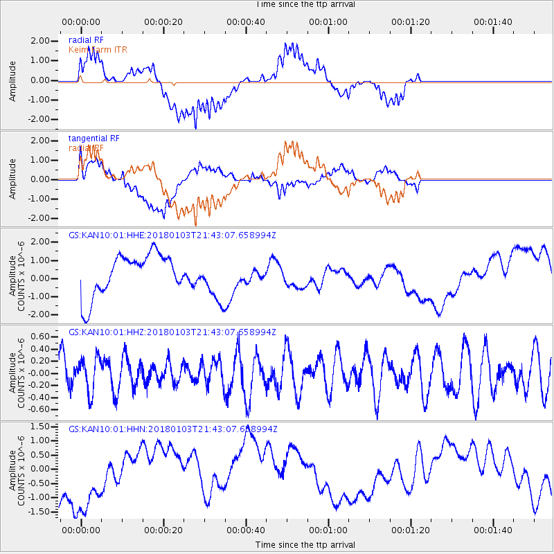
Signal To Noise
| Channel | StoN | STA | LTA |
| GS:KAN10:01:HHZ:20180103T21:43:07.658994Z | 1.2018157 | 2.9047987E-7 | 2.4170083E-7 |
| GS:KAN10:01:HHN:20180103T21:43:07.658994Z | 1.6710362 | 1.3981185E-6 | 8.366775E-7 |
| GS:KAN10:01:HHE:20180103T21:43:07.658994Z | 1.116298 | 1.2766844E-6 | 1.1436772E-6 |
| Arrivals |
| Ps | |
| PpPs | |
| PsPs/PpSs | |


