You are here: Home > Network List > IU - Global Seismograph Network (GSN - IRIS/USGS) Stations List
> Station XMAS Kiritimati Island, Republic of Kiribati > Earthquake Result Viewer
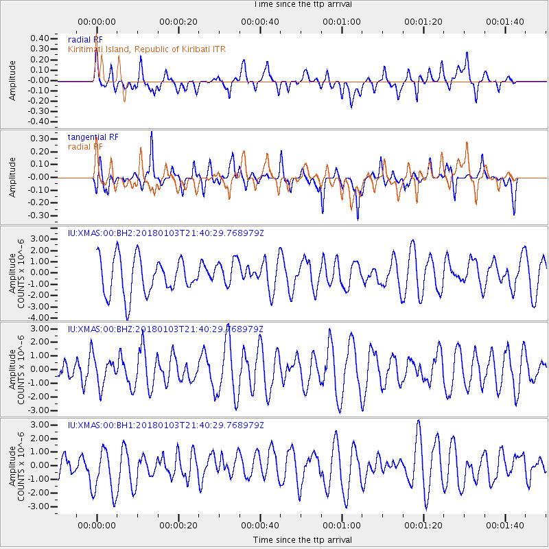
XMAS Kiritimati Island, Republic of Kiribati - Earthquake Result Viewer
*The percent match for this event was below the threshold and hence no stack was calculated.
| Earthquake location: |
Southeast Of Honshu, Japan |
| Earthquake latitude/longitude: |
29.6/140.5 |
| Earthquake time(UTC): |
2018/01/03 (003) 21:30:21 GMT |
| Earthquake Depth: |
9.5 km |
| Earthquake Magnitude: |
5.5 Mww |
| Earthquake Catalog/Contributor: |
NEIC PDE/us |
|
| Network: |
IU Global Seismograph Network (GSN - IRIS/USGS) |
| Station: |
XMAS Kiritimati Island, Republic of Kiribati |
| Lat/Lon: |
2.04 N/157.45 W |
| Elevation: |
20 m |
|
| Distance: |
64.8 deg |
| Az: |
102.75 deg |
| Baz: |
301.825 deg |
| Ray Param: |
$rayparam |
*The percent match for this event was below the threshold and hence was not used in the summary stack. |
|
| Radial Match: |
42.768154 % |
| Radial Bump: |
400 |
| Transverse Match: |
49.591347 % |
| Transverse Bump: |
363 |
| SOD ConfigId: |
2528331 |
| Insert Time: |
2018-01-20 00:36:55.041 +0000 |
| GWidth: |
2.5 |
| Max Bumps: |
400 |
| Tol: |
0.001 |
|
Signal To Noise
| Channel | StoN | STA | LTA |
| IU:XMAS:00:BHZ:20180103T21:40:29.768979Z | 0.8977679 | 9.555428E-7 | 1.0643538E-6 |
| IU:XMAS:00:BH1:20180103T21:40:29.768979Z | 1.9839242 | 1.8146442E-6 | 9.1467416E-7 |
| IU:XMAS:00:BH2:20180103T21:40:29.768979Z | 0.7459654 | 1.2089821E-6 | 1.6206945E-6 |
| Arrivals |
| Ps | |
| PpPs | |
| PsPs/PpSs | |


