You are here: Home > Network List > US - United States National Seismic Network Stations List
> Station EGMT Eagleton, Montana, USA > Earthquake Result Viewer
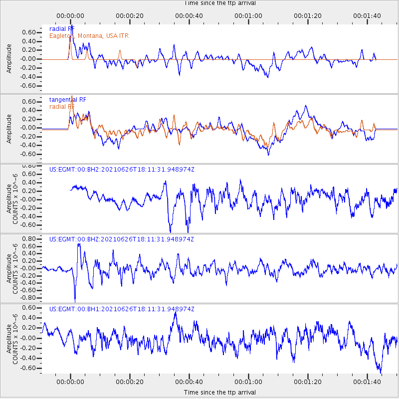
EGMT Eagleton, Montana, USA - Earthquake Result Viewer
*The percent match for this event was below the threshold and hence no stack was calculated.
| Earthquake location: |
Northern Mid-Atlantic Ridge |
| Earthquake latitude/longitude: |
11.8/-44.2 |
| Earthquake time(UTC): |
2021/06/26 (177) 18:01:22 GMT |
| Earthquake Depth: |
5.7 km |
| Earthquake Magnitude: |
5.6 mww |
| Earthquake Catalog/Contributor: |
NEIC PDE/us |
|
| Network: |
US United States National Seismic Network |
| Station: |
EGMT Eagleton, Montana, USA |
| Lat/Lon: |
48.02 N/109.75 W |
| Elevation: |
1055 m |
|
| Distance: |
65.0 deg |
| Az: |
317.605 deg |
| Baz: |
100.436 deg |
| Ray Param: |
$rayparam |
*The percent match for this event was below the threshold and hence was not used in the summary stack. |
|
| Radial Match: |
52.58584 % |
| Radial Bump: |
400 |
| Transverse Match: |
51.633 % |
| Transverse Bump: |
400 |
| SOD ConfigId: |
25131211 |
| Insert Time: |
2021-07-10 18:31:34.566 +0000 |
| GWidth: |
2.5 |
| Max Bumps: |
400 |
| Tol: |
0.001 |
|
Signal To Noise
| Channel | StoN | STA | LTA |
| US:EGMT:00:BHZ:20210626T18:11:31.948974Z | 8.710942 | 3.864671E-7 | 4.4365706E-8 |
| US:EGMT:00:BH1:20210626T18:11:31.948974Z | 0.81799453 | 1.406674E-7 | 1.7196618E-7 |
| US:EGMT:00:BH2:20210626T18:11:31.948974Z | 2.290154 | 3.687503E-7 | 1.6101552E-7 |
| Arrivals |
| Ps | |
| PpPs | |
| PsPs/PpSs | |


