You are here: Home > Network List > US - United States National Seismic Network Stations List
> Station GLMI Grayling, Michigan, USA > Earthquake Result Viewer
GLMI Grayling, Michigan, USA - Earthquake Result Viewer
*The percent match for this event was below the threshold and hence no stack was calculated.
| Earthquake location: |
Northern Mid-Atlantic Ridge |
| Earthquake latitude/longitude: |
11.8/-44.2 |
| Earthquake time(UTC): |
2021/06/26 (177) 18:01:22 GMT |
| Earthquake Depth: |
5.7 km |
| Earthquake Magnitude: |
5.6 mww |
| Earthquake Catalog/Contributor: |
NEIC PDE/us |
|
| Network: |
US United States National Seismic Network |
| Station: |
GLMI Grayling, Michigan, USA |
| Lat/Lon: |
44.82 N/84.62 W |
| Elevation: |
387 m |
|
| Distance: |
47.7 deg |
| Az: |
321.403 deg |
| Baz: |
120.866 deg |
| Ray Param: |
$rayparam |
*The percent match for this event was below the threshold and hence was not used in the summary stack. |
|
| Radial Match: |
72.19692 % |
| Radial Bump: |
400 |
| Transverse Match: |
57.19395 % |
| Transverse Bump: |
400 |
| SOD ConfigId: |
25131211 |
| Insert Time: |
2021-07-10 18:31:40.311 +0000 |
| GWidth: |
2.5 |
| Max Bumps: |
400 |
| Tol: |
0.001 |
|
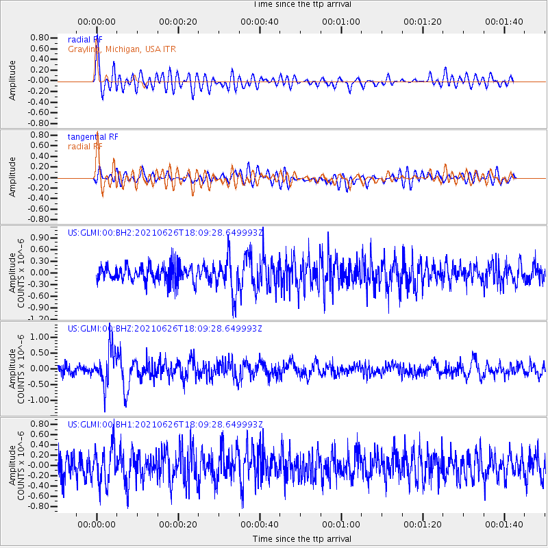
Signal To Noise
| Channel | StoN | STA | LTA |
| US:GLMI:00:BHZ:20210626T18:09:28.649993Z | 5.173239 | 5.6522805E-7 | 1.0925999E-7 |
| US:GLMI:00:BH1:20210626T18:09:28.649993Z | 1.5982915 | 3.5901485E-7 | 2.2462415E-7 |
| US:GLMI:00:BH2:20210626T18:09:28.649993Z | 2.211948 | 4.682161E-7 | 2.116759E-7 |
| Arrivals |
| Ps | |
| PpPs | |
| PsPs/PpSs | |


