You are here: Home > Network List > GS - US Geological Survey Networks Stations List
> Station OK051 E0350 and S34600 Roads, Ralston, OK > Earthquake Result Viewer
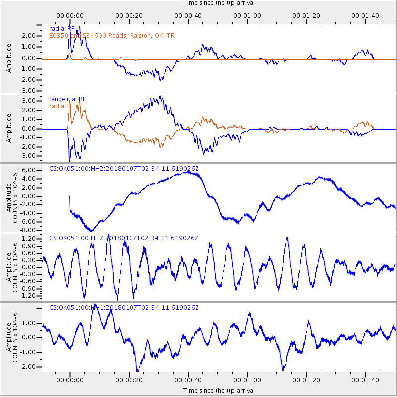
OK051 E0350 and S34600 Roads, Ralston, OK - Earthquake Result Viewer
*The percent match for this event was below the threshold and hence no stack was calculated.
| Earthquake location: |
Komandorskiye Ostrova Region |
| Earthquake latitude/longitude: |
55.1/165.7 |
| Earthquake time(UTC): |
2018/01/07 (007) 02:24:06 GMT |
| Earthquake Depth: |
35 km |
| Earthquake Magnitude: |
5.7 mb |
| Earthquake Catalog/Contributor: |
NEIC PDE/us |
|
| Network: |
GS US Geological Survey Networks |
| Station: |
OK051 E0350 and S34600 Roads, Ralston, OK |
| Lat/Lon: |
36.51 N/96.84 W |
| Elevation: |
263 m |
|
| Distance: |
64.9 deg |
| Az: |
61.919 deg |
| Baz: |
320.963 deg |
| Ray Param: |
$rayparam |
*The percent match for this event was below the threshold and hence was not used in the summary stack. |
|
| Radial Match: |
74.21006 % |
| Radial Bump: |
400 |
| Transverse Match: |
72.17475 % |
| Transverse Bump: |
400 |
| SOD ConfigId: |
2528331 |
| Insert Time: |
2018-01-21 02:25:41.016 +0000 |
| GWidth: |
2.5 |
| Max Bumps: |
400 |
| Tol: |
0.001 |
|
Signal To Noise
| Channel | StoN | STA | LTA |
| GS:OK051:00:HHZ:20180107T02:34:11.619026Z | 2.254515 | 6.4118626E-7 | 2.8440098E-7 |
| GS:OK051:00:HH1:20180107T02:34:11.619026Z | 0.9518601 | 8.600263E-7 | 9.0352177E-7 |
| GS:OK051:00:HH2:20180107T02:34:11.619026Z | 2.4616761 | 7.300133E-6 | 2.965513E-6 |
| Arrivals |
| Ps | |
| PpPs | |
| PsPs/PpSs | |


