You are here: Home > Network List > UW - Pacific Northwest Regional Seismic Network Stations List
> Station UMAT Pilot Rock, OR, USA > Earthquake Result Viewer
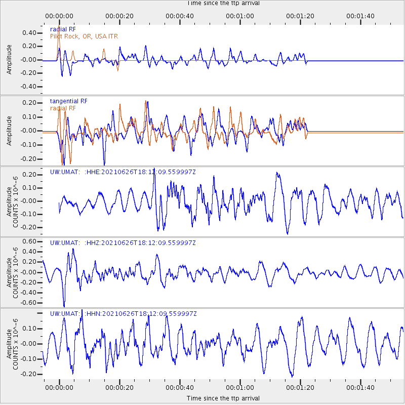
UMAT Pilot Rock, OR, USA - Earthquake Result Viewer
*The percent match for this event was below the threshold and hence no stack was calculated.
| Earthquake location: |
Northern Mid-Atlantic Ridge |
| Earthquake latitude/longitude: |
11.8/-44.2 |
| Earthquake time(UTC): |
2021/06/26 (177) 18:01:22 GMT |
| Earthquake Depth: |
5.7 km |
| Earthquake Magnitude: |
5.6 mww |
| Earthquake Catalog/Contributor: |
NEIC PDE/us |
|
| Network: |
UW Pacific Northwest Regional Seismic Network |
| Station: |
UMAT Pilot Rock, OR, USA |
| Lat/Lon: |
45.29 N/118.96 W |
| Elevation: |
1318 m |
|
| Distance: |
71.0 deg |
| Az: |
313.921 deg |
| Baz: |
92.372 deg |
| Ray Param: |
$rayparam |
*The percent match for this event was below the threshold and hence was not used in the summary stack. |
|
| Radial Match: |
52.318756 % |
| Radial Bump: |
387 |
| Transverse Match: |
57.849407 % |
| Transverse Bump: |
400 |
| SOD ConfigId: |
25131211 |
| Insert Time: |
2021-07-10 18:34:32.278 +0000 |
| GWidth: |
2.5 |
| Max Bumps: |
400 |
| Tol: |
0.001 |
|
Signal To Noise
| Channel | StoN | STA | LTA |
| UW:UMAT: :HHZ:20210626T18:12:09.559997Z | 2.6053574 | 2.830433E-7 | 1.08638964E-7 |
| UW:UMAT: :HHN:20210626T18:12:09.559997Z | 1.5689737 | 1.07134504E-7 | 6.828318E-8 |
| UW:UMAT: :HHE:20210626T18:12:09.559997Z | 2.517297 | 1.2610585E-7 | 5.0095736E-8 |
| Arrivals |
| Ps | |
| PpPs | |
| PsPs/PpSs | |


