You are here: Home > Network List > WY - Yellowstone Wyoming Seismic Network Stations List
> Station YHH Holmes Hill, YNP, WY, USA > Earthquake Result Viewer
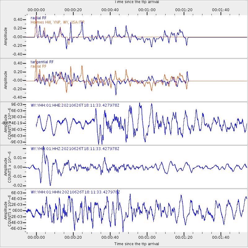
YHH Holmes Hill, YNP, WY, USA - Earthquake Result Viewer
*The percent match for this event was below the threshold and hence no stack was calculated.
| Earthquake location: |
Northern Mid-Atlantic Ridge |
| Earthquake latitude/longitude: |
11.8/-44.2 |
| Earthquake time(UTC): |
2021/06/26 (177) 18:01:22 GMT |
| Earthquake Depth: |
5.7 km |
| Earthquake Magnitude: |
5.6 mww |
| Earthquake Catalog/Contributor: |
NEIC PDE/us |
|
| Network: |
WY Yellowstone Wyoming Seismic Network |
| Station: |
YHH Holmes Hill, YNP, WY, USA |
| Lat/Lon: |
44.79 N/110.85 W |
| Elevation: |
2717 m |
|
| Distance: |
65.2 deg |
| Az: |
313.948 deg |
| Baz: |
98.106 deg |
| Ray Param: |
$rayparam |
*The percent match for this event was below the threshold and hence was not used in the summary stack. |
|
| Radial Match: |
76.10759 % |
| Radial Bump: |
400 |
| Transverse Match: |
57.379467 % |
| Transverse Bump: |
400 |
| SOD ConfigId: |
25131211 |
| Insert Time: |
2021-07-10 18:35:23.239 +0000 |
| GWidth: |
2.5 |
| Max Bumps: |
400 |
| Tol: |
0.001 |
|
Signal To Noise
| Channel | StoN | STA | LTA |
| WY:YHH:01:HHZ:20210626T18:11:33.427978Z | 8.196211 | 9.751124E-9 | 1.1897113E-9 |
| WY:YHH:01:HHN:20210626T18:11:33.427978Z | 0.8172763 | 2.0085331E-9 | 2.4575937E-9 |
| WY:YHH:01:HHE:20210626T18:11:33.427978Z | 1.6903696 | 4.124833E-9 | 2.4401958E-9 |
| Arrivals |
| Ps | |
| PpPs | |
| PsPs/PpSs | |


