You are here: Home > Network List > UU - University of Utah Regional Network Stations List
> Station FORU South Mineral Mountains, UT, USA > Earthquake Result Viewer
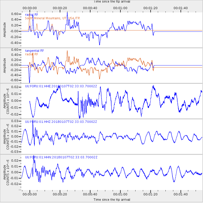
FORU South Mineral Mountains, UT, USA - Earthquake Result Viewer
*The percent match for this event was below the threshold and hence no stack was calculated.
| Earthquake location: |
Komandorskiye Ostrova Region |
| Earthquake latitude/longitude: |
55.1/165.7 |
| Earthquake time(UTC): |
2018/01/07 (007) 02:24:06 GMT |
| Earthquake Depth: |
35 km |
| Earthquake Magnitude: |
5.7 mb |
| Earthquake Catalog/Contributor: |
NEIC PDE/us |
|
| Network: |
UU University of Utah Regional Network |
| Station: |
FORU South Mineral Mountains, UT, USA |
| Lat/Lon: |
38.46 N/112.86 W |
| Elevation: |
1840 m |
|
| Distance: |
55.0 deg |
| Az: |
71.446 deg |
| Baz: |
316.011 deg |
| Ray Param: |
$rayparam |
*The percent match for this event was below the threshold and hence was not used in the summary stack. |
|
| Radial Match: |
62.73722 % |
| Radial Bump: |
400 |
| Transverse Match: |
71.71875 % |
| Transverse Bump: |
400 |
| SOD ConfigId: |
2528331 |
| Insert Time: |
2018-01-21 02:28:33.560 +0000 |
| GWidth: |
2.5 |
| Max Bumps: |
400 |
| Tol: |
0.001 |
|
Signal To Noise
| Channel | StoN | STA | LTA |
| UU:FORU:01:HHZ:20180107T02:33:03.70002Z | 1.7679197 | 1.2609943E-8 | 7.132645E-9 |
| UU:FORU:01:HHN:20180107T02:33:03.70002Z | 2.0524027 | 1.1802285E-8 | 5.7504725E-9 |
| UU:FORU:01:HHE:20180107T02:33:03.70002Z | 1.1119953 | 1.2244127E-8 | 1.1010952E-8 |
| Arrivals |
| Ps | |
| PpPs | |
| PsPs/PpSs | |


