You are here: Home > Network List > CI - Caltech Regional Seismic Network Stations List
> Station MPP McPhearson Peak > Earthquake Result Viewer
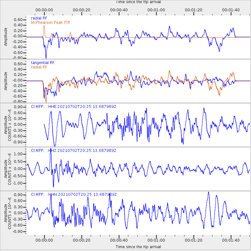
MPP McPhearson Peak - Earthquake Result Viewer
*The percent match for this event was below the threshold and hence no stack was calculated.
| Earthquake location: |
Fiji Islands Region |
| Earthquake latitude/longitude: |
-21.8/-179.4 |
| Earthquake time(UTC): |
2021/07/02 (183) 20:14:38 GMT |
| Earthquake Depth: |
606 km |
| Earthquake Magnitude: |
6.1 Mww |
| Earthquake Catalog/Contributor: |
NEIC PDE/us |
|
| Network: |
CI Caltech Regional Seismic Network |
| Station: |
MPP McPhearson Peak |
| Lat/Lon: |
34.89 N/119.81 W |
| Elevation: |
1739 m |
|
| Distance: |
79.8 deg |
| Az: |
46.053 deg |
| Baz: |
234.466 deg |
| Ray Param: |
$rayparam |
*The percent match for this event was below the threshold and hence was not used in the summary stack. |
|
| Radial Match: |
64.323494 % |
| Radial Bump: |
400 |
| Transverse Match: |
51.006256 % |
| Transverse Bump: |
400 |
| SOD ConfigId: |
25131211 |
| Insert Time: |
2021-07-16 20:25:17.055 +0000 |
| GWidth: |
2.5 |
| Max Bumps: |
400 |
| Tol: |
0.001 |
|
Signal To Noise
| Channel | StoN | STA | LTA |
| CI:MPP: :HHZ:20210702T20:25:13.687989Z | 2.0399487 | 4.876413E-7 | 2.3904587E-7 |
| CI:MPP: :HHN:20210702T20:25:13.687989Z | 1.6140604 | 3.39697E-7 | 2.1046114E-7 |
| CI:MPP: :HHE:20210702T20:25:13.687989Z | 0.5391853 | 2.4217317E-7 | 4.4914648E-7 |
| Arrivals |
| Ps | |
| PpPs | |
| PsPs/PpSs | |


