You are here: Home > Network List > G - GEOSCOPE Stations List
> Station INU Inuyama, Japan > Earthquake Result Viewer
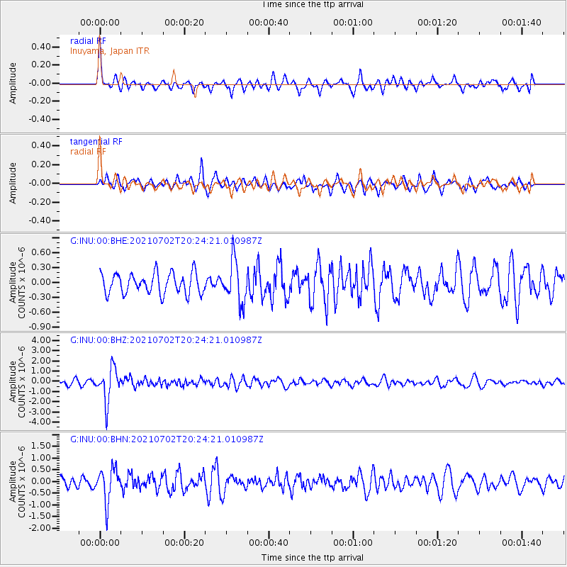
INU Inuyama, Japan - Earthquake Result Viewer
*The percent match for this event was below the threshold and hence no stack was calculated.
| Earthquake location: |
Fiji Islands Region |
| Earthquake latitude/longitude: |
-21.8/-179.4 |
| Earthquake time(UTC): |
2021/07/02 (183) 20:14:38 GMT |
| Earthquake Depth: |
606 km |
| Earthquake Magnitude: |
6.1 Mww |
| Earthquake Catalog/Contributor: |
NEIC PDE/us |
|
| Network: |
G GEOSCOPE |
| Station: |
INU Inuyama, Japan |
| Lat/Lon: |
35.35 N/137.03 E |
| Elevation: |
132 m |
|
| Distance: |
70.3 deg |
| Az: |
323.211 deg |
| Baz: |
137.103 deg |
| Ray Param: |
$rayparam |
*The percent match for this event was below the threshold and hence was not used in the summary stack. |
|
| Radial Match: |
52.823463 % |
| Radial Bump: |
395 |
| Transverse Match: |
64.80188 % |
| Transverse Bump: |
400 |
| SOD ConfigId: |
25131211 |
| Insert Time: |
2021-07-16 20:27:00.742 +0000 |
| GWidth: |
2.5 |
| Max Bumps: |
400 |
| Tol: |
0.001 |
|
Signal To Noise
| Channel | StoN | STA | LTA |
| G:INU:00:BHZ:20210702T20:24:21.010987Z | 5.94367 | 1.6547218E-6 | 2.784007E-7 |
| G:INU:00:BHN:20210702T20:24:21.010987Z | 4.1405096 | 7.204069E-7 | 1.739899E-7 |
| G:INU:00:BHE:20210702T20:24:21.010987Z | 2.0802374 | 4.3056212E-7 | 2.069774E-7 |
| Arrivals |
| Ps | |
| PpPs | |
| PsPs/PpSs | |


