You are here: Home > Network List > IU - Global Seismograph Network (GSN - IRIS/USGS) Stations List
> Station JOHN Johnston Island, USA > Earthquake Result Viewer
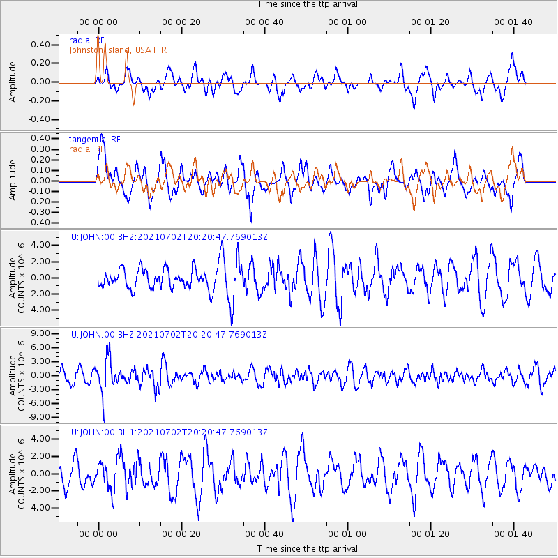
JOHN Johnston Island, USA - Earthquake Result Viewer
*The percent match for this event was below the threshold and hence no stack was calculated.
| Earthquake location: |
Fiji Islands Region |
| Earthquake latitude/longitude: |
-21.8/-179.4 |
| Earthquake time(UTC): |
2021/07/02 (183) 20:14:38 GMT |
| Earthquake Depth: |
606 km |
| Earthquake Magnitude: |
6.1 Mww |
| Earthquake Catalog/Contributor: |
NEIC PDE/us |
|
| Network: |
IU Global Seismograph Network (GSN - IRIS/USGS) |
| Station: |
JOHN Johnston Island, USA |
| Lat/Lon: |
16.73 N/169.53 W |
| Elevation: |
2.0 m |
|
| Distance: |
39.5 deg |
| Az: |
14.902 deg |
| Baz: |
194.44 deg |
| Ray Param: |
$rayparam |
*The percent match for this event was below the threshold and hence was not used in the summary stack. |
|
| Radial Match: |
45.106956 % |
| Radial Bump: |
400 |
| Transverse Match: |
68.531204 % |
| Transverse Bump: |
400 |
| SOD ConfigId: |
25131211 |
| Insert Time: |
2021-07-16 20:28:25.479 +0000 |
| GWidth: |
2.5 |
| Max Bumps: |
400 |
| Tol: |
0.001 |
|
Signal To Noise
| Channel | StoN | STA | LTA |
| IU:JOHN:00:BHZ:20210702T20:20:47.769013Z | 2.4949837 | 3.89835E-6 | 1.5624751E-6 |
| IU:JOHN:00:BH1:20210702T20:20:47.769013Z | 1.1670079 | 1.6862862E-6 | 1.4449655E-6 |
| IU:JOHN:00:BH2:20210702T20:20:47.769013Z | 2.824154 | 3.017369E-6 | 1.0684153E-6 |
| Arrivals |
| Ps | |
| PpPs | |
| PsPs/PpSs | |


