You are here: Home > Network List > IW - Intermountain West Stations List
> Station PLID Pearl Lake, Idaho, USA > Earthquake Result Viewer
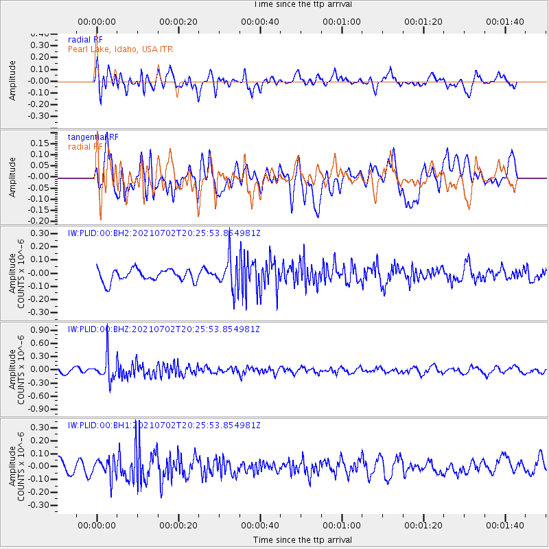
PLID Pearl Lake, Idaho, USA - Earthquake Result Viewer
*The percent match for this event was below the threshold and hence no stack was calculated.
| Earthquake location: |
Fiji Islands Region |
| Earthquake latitude/longitude: |
-21.8/-179.4 |
| Earthquake time(UTC): |
2021/07/02 (183) 20:14:38 GMT |
| Earthquake Depth: |
606 km |
| Earthquake Magnitude: |
6.1 Mww |
| Earthquake Catalog/Contributor: |
NEIC PDE/us |
|
| Network: |
IW Intermountain West |
| Station: |
PLID Pearl Lake, Idaho, USA |
| Lat/Lon: |
45.09 N/116.00 W |
| Elevation: |
2164 m |
|
| Distance: |
88.0 deg |
| Az: |
39.315 deg |
| Baz: |
236.203 deg |
| Ray Param: |
$rayparam |
*The percent match for this event was below the threshold and hence was not used in the summary stack. |
|
| Radial Match: |
53.75187 % |
| Radial Bump: |
400 |
| Transverse Match: |
44.175808 % |
| Transverse Bump: |
400 |
| SOD ConfigId: |
25131211 |
| Insert Time: |
2021-07-16 20:28:43.947 +0000 |
| GWidth: |
2.5 |
| Max Bumps: |
400 |
| Tol: |
0.001 |
|
Signal To Noise
| Channel | StoN | STA | LTA |
| IW:PLID:00:BHZ:20210702T20:25:53.854981Z | 4.616421 | 2.78749E-7 | 6.0382064E-8 |
| IW:PLID:00:BH1:20210702T20:25:53.854981Z | 1.5945673 | 7.273608E-8 | 4.5614932E-8 |
| IW:PLID:00:BH2:20210702T20:25:53.854981Z | 2.661013 | 1.217226E-7 | 4.574296E-8 |
| Arrivals |
| Ps | |
| PpPs | |
| PsPs/PpSs | |


