You are here: Home > Network List > US - United States National Seismic Network Stations List
> Station DUG Dugway, Tooele County, Utah, USA > Earthquake Result Viewer
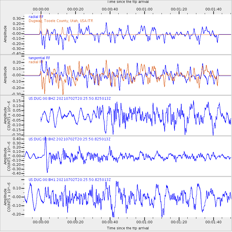
DUG Dugway, Tooele County, Utah, USA - Earthquake Result Viewer
*The percent match for this event was below the threshold and hence no stack was calculated.
| Earthquake location: |
Fiji Islands Region |
| Earthquake latitude/longitude: |
-21.8/-179.4 |
| Earthquake time(UTC): |
2021/07/02 (183) 20:14:38 GMT |
| Earthquake Depth: |
606 km |
| Earthquake Magnitude: |
6.1 Mww |
| Earthquake Catalog/Contributor: |
NEIC PDE/us |
|
| Network: |
US United States National Seismic Network |
| Station: |
DUG Dugway, Tooele County, Utah, USA |
| Lat/Lon: |
40.19 N/112.81 W |
| Elevation: |
1477 m |
|
| Distance: |
87.4 deg |
| Az: |
44.704 deg |
| Baz: |
238.571 deg |
| Ray Param: |
$rayparam |
*The percent match for this event was below the threshold and hence was not used in the summary stack. |
|
| Radial Match: |
56.538376 % |
| Radial Bump: |
400 |
| Transverse Match: |
56.464886 % |
| Transverse Bump: |
400 |
| SOD ConfigId: |
25131211 |
| Insert Time: |
2021-07-16 20:35:24.375 +0000 |
| GWidth: |
2.5 |
| Max Bumps: |
400 |
| Tol: |
0.001 |
|
Signal To Noise
| Channel | StoN | STA | LTA |
| US:DUG:00:BHZ:20210702T20:25:50.825013Z | 3.3419766 | 1.9376698E-7 | 5.797975E-8 |
| US:DUG:00:BH1:20210702T20:25:50.825013Z | 0.76266277 | 5.4818337E-8 | 7.187756E-8 |
| US:DUG:00:BH2:20210702T20:25:50.825013Z | 0.96835816 | 4.6267562E-8 | 4.777939E-8 |
| Arrivals |
| Ps | |
| PpPs | |
| PsPs/PpSs | |


