You are here: Home > Network List > UU - University of Utah Regional Network Stations List
> Station KNB Kanab, UT, USA > Earthquake Result Viewer
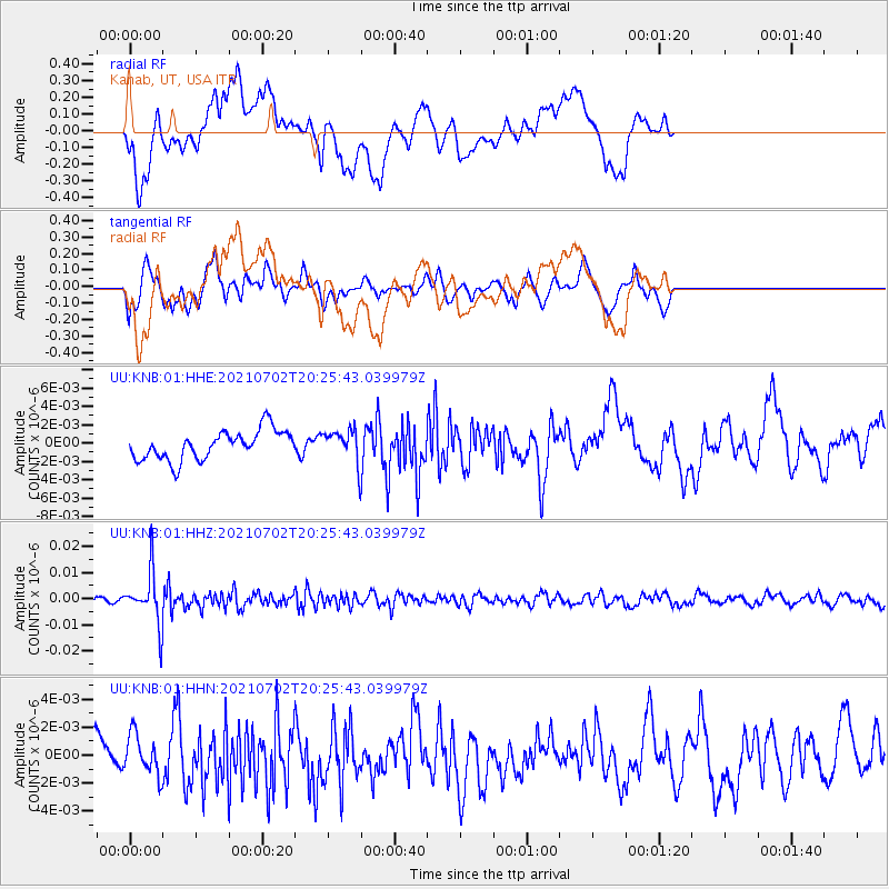
KNB Kanab, UT, USA - Earthquake Result Viewer
*The percent match for this event was below the threshold and hence no stack was calculated.
| Earthquake location: |
Fiji Islands Region |
| Earthquake latitude/longitude: |
-21.8/-179.4 |
| Earthquake time(UTC): |
2021/07/02 (183) 20:14:38 GMT |
| Earthquake Depth: |
606 km |
| Earthquake Magnitude: |
6.1 Mww |
| Earthquake Catalog/Contributor: |
NEIC PDE/us |
|
| Network: |
UU University of Utah Regional Network |
| Station: |
KNB Kanab, UT, USA |
| Lat/Lon: |
37.02 N/112.82 W |
| Elevation: |
1715 m |
|
| Distance: |
85.7 deg |
| Az: |
47.416 deg |
| Baz: |
238.729 deg |
| Ray Param: |
$rayparam |
*The percent match for this event was below the threshold and hence was not used in the summary stack. |
|
| Radial Match: |
54.755768 % |
| Radial Bump: |
400 |
| Transverse Match: |
55.83547 % |
| Transverse Bump: |
400 |
| SOD ConfigId: |
25131211 |
| Insert Time: |
2021-07-16 20:36:06.945 +0000 |
| GWidth: |
2.5 |
| Max Bumps: |
400 |
| Tol: |
0.001 |
|
Signal To Noise
| Channel | StoN | STA | LTA |
| UU:KNB:01:HHZ:20210702T20:25:43.039979Z | 6.5254917 | 9.63164E-9 | 1.4760023E-9 |
| UU:KNB:01:HHN:20210702T20:25:43.039979Z | 0.8628729 | 1.4241839E-9 | 1.6505142E-9 |
| UU:KNB:01:HHE:20210702T20:25:43.039979Z | 1.0828625 | 1.7314452E-9 | 1.5989521E-9 |
| Arrivals |
| Ps | |
| PpPs | |
| PsPs/PpSs | |


