You are here: Home > Network List > UW - Pacific Northwest Regional Seismic Network Stations List
> Station UMAT Pilot Rock, OR, USA > Earthquake Result Viewer
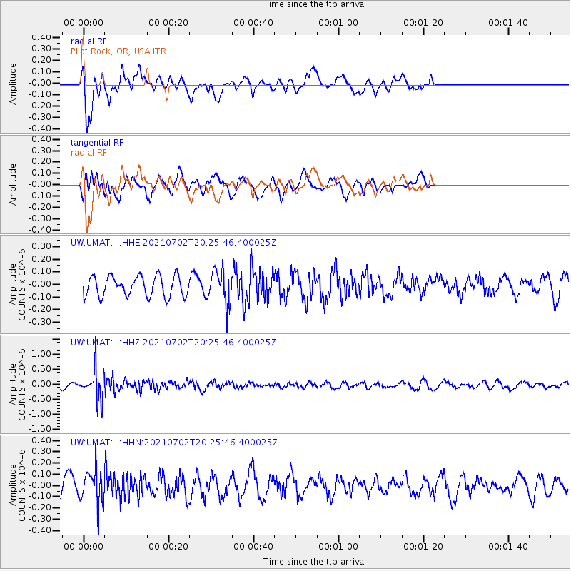
UMAT Pilot Rock, OR, USA - Earthquake Result Viewer
*The percent match for this event was below the threshold and hence no stack was calculated.
| Earthquake location: |
Fiji Islands Region |
| Earthquake latitude/longitude: |
-21.8/-179.4 |
| Earthquake time(UTC): |
2021/07/02 (183) 20:14:38 GMT |
| Earthquake Depth: |
606 km |
| Earthquake Magnitude: |
6.1 Mww |
| Earthquake Catalog/Contributor: |
NEIC PDE/us |
|
| Network: |
UW Pacific Northwest Regional Seismic Network |
| Station: |
UMAT Pilot Rock, OR, USA |
| Lat/Lon: |
45.29 N/118.96 W |
| Elevation: |
1318 m |
|
| Distance: |
86.4 deg |
| Az: |
37.95 deg |
| Baz: |
234.045 deg |
| Ray Param: |
$rayparam |
*The percent match for this event was below the threshold and hence was not used in the summary stack. |
|
| Radial Match: |
69.71311 % |
| Radial Bump: |
400 |
| Transverse Match: |
53.47039 % |
| Transverse Bump: |
400 |
| SOD ConfigId: |
25131211 |
| Insert Time: |
2021-07-16 20:37:48.473 +0000 |
| GWidth: |
2.5 |
| Max Bumps: |
400 |
| Tol: |
0.001 |
|
Signal To Noise
| Channel | StoN | STA | LTA |
| UW:UMAT: :HHZ:20210702T20:25:46.400025Z | 7.2473416 | 4.8859675E-7 | 6.741738E-8 |
| UW:UMAT: :HHN:20210702T20:25:46.400025Z | 1.6155392 | 1.5431273E-7 | 9.551779E-8 |
| UW:UMAT: :HHE:20210702T20:25:46.400025Z | 1.6309776 | 1.3063897E-7 | 8.009856E-8 |
| Arrivals |
| Ps | |
| PpPs | |
| PsPs/PpSs | |


