You are here: Home > Network List > II - Global Seismograph Network (GSN - IRIS/IDA) Stations List
> Station ABPO Ambohimpanompo, Madagascar > Earthquake Result Viewer
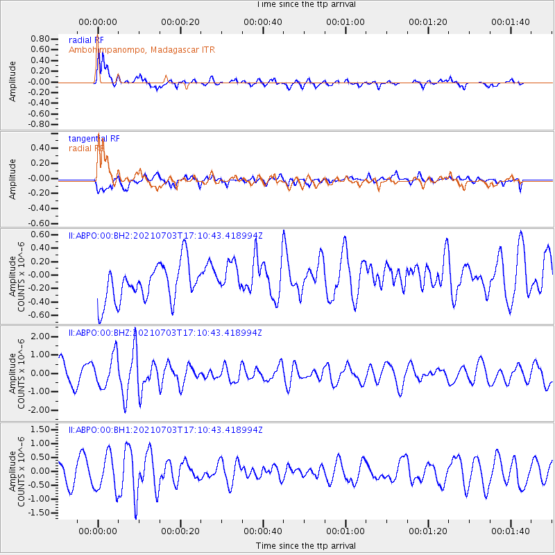
ABPO Ambohimpanompo, Madagascar - Earthquake Result Viewer

| Earthquake location: |
Owen Fracture Zone Region |
| Earthquake latitude/longitude: |
14.2/56.8 |
| Earthquake time(UTC): |
2021/07/03 (184) 17:04:27 GMT |
| Earthquake Depth: |
10 km |
| Earthquake Magnitude: |
5.6 mww |
| Earthquake Catalog/Contributor: |
NEIC PDE/us |
|
| Network: |
II Global Seismograph Network (GSN - IRIS/IDA) |
| Station: |
ABPO Ambohimpanompo, Madagascar |
| Lat/Lon: |
19.02 S/47.23 E |
| Elevation: |
1528 m |
|
| Distance: |
34.4 deg |
| Az: |
196.116 deg |
| Baz: |
16.529 deg |
| Ray Param: |
0.077785894 |
| Estimated Moho Depth: |
13.0 km |
| Estimated Crust Vp/Vs: |
1.60 |
| Assumed Crust Vp: |
6.642 km/s |
| Estimated Crust Vs: |
4.151 km/s |
| Estimated Crust Poisson's Ratio: |
0.18 |
|
| Radial Match: |
81.393776 % |
| Radial Bump: |
400 |
| Transverse Match: |
66.71737 % |
| Transverse Bump: |
400 |
| SOD ConfigId: |
25131211 |
| Insert Time: |
2021-07-17 17:08:19.663 +0000 |
| GWidth: |
2.5 |
| Max Bumps: |
400 |
| Tol: |
0.001 |
|
Signal To Noise
| Channel | StoN | STA | LTA |
| II:ABPO:00:BHZ:20210703T17:10:43.418994Z | 1.4771409 | 8.8543214E-7 | 5.9942295E-7 |
| II:ABPO:00:BH1:20210703T17:10:43.418994Z | 1.6500643 | 6.532845E-7 | 3.9591455E-7 |
| II:ABPO:00:BH2:20210703T17:10:43.418994Z | 0.8559108 | 2.3513321E-7 | 2.7471697E-7 |
| Arrivals |
| Ps | 1.3 SECOND |
| PpPs | 4.6 SECOND |
| PsPs/PpSs | 5.9 SECOND |


