You are here: Home > Network List > IU - Global Seismograph Network (GSN - IRIS/USGS) Stations List
> Station CTAO Charters Towers, Australia > Earthquake Result Viewer
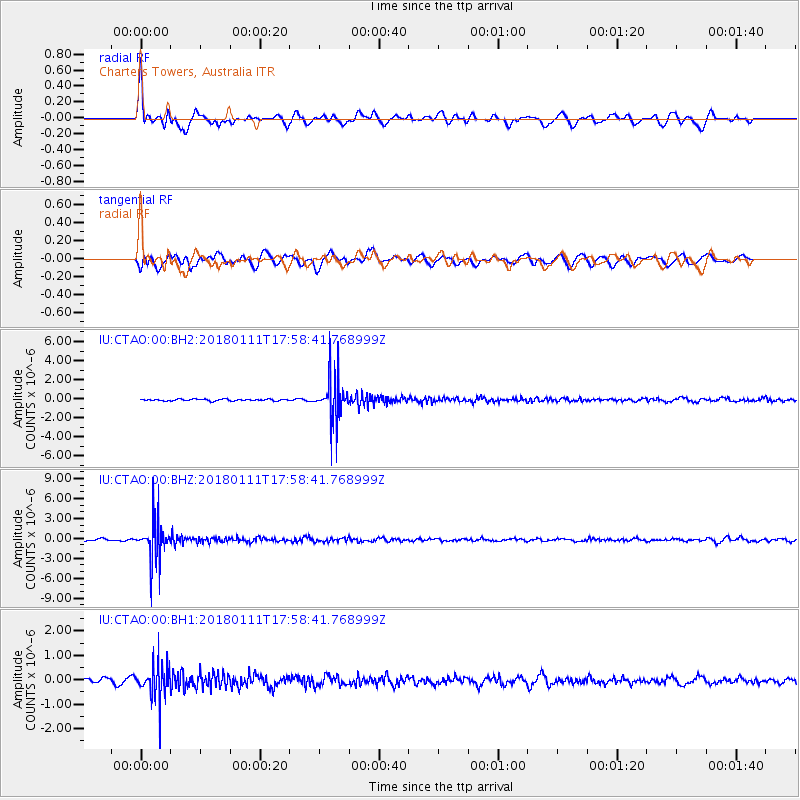
CTAO Charters Towers, Australia - Earthquake Result Viewer
*The percent match for this event was below the threshold and hence no stack was calculated.
| Earthquake location: |
South Of Fiji Islands |
| Earthquake latitude/longitude: |
-23.9/180.0 |
| Earthquake time(UTC): |
2018/01/11 (011) 17:53:33 GMT |
| Earthquake Depth: |
508 km |
| Earthquake Magnitude: |
5.5 Mww |
| Earthquake Catalog/Contributor: |
NEIC PDE/us |
|
| Network: |
IU Global Seismograph Network (GSN - IRIS/USGS) |
| Station: |
CTAO Charters Towers, Australia |
| Lat/Lon: |
20.09 S/146.25 E |
| Elevation: |
357 m |
|
| Distance: |
31.4 deg |
| Az: |
270.305 deg |
| Baz: |
103.183 deg |
| Ray Param: |
$rayparam |
*The percent match for this event was below the threshold and hence was not used in the summary stack. |
|
| Radial Match: |
79.562294 % |
| Radial Bump: |
400 |
| Transverse Match: |
61.81877 % |
| Transverse Bump: |
400 |
| SOD ConfigId: |
2528331 |
| Insert Time: |
2018-01-25 17:54:28.186 +0000 |
| GWidth: |
2.5 |
| Max Bumps: |
400 |
| Tol: |
0.001 |
|
Signal To Noise
| Channel | StoN | STA | LTA |
| IU:CTAO:00:BHZ:20180111T17:58:41.768999Z | 17.102457 | 2.9975017E-6 | 1.7526732E-7 |
| IU:CTAO:00:BH1:20180111T17:58:41.768999Z | 4.7863283 | 7.0165027E-7 | 1.4659469E-7 |
| IU:CTAO:00:BH2:20180111T17:58:41.768999Z | 26.16663 | 2.2490856E-6 | 8.5952436E-8 |
| Arrivals |
| Ps | |
| PpPs | |
| PsPs/PpSs | |


