You are here: Home > Network List > US - United States National Seismic Network Stations List
> Station MSO Missoula, Montana, USA > Earthquake Result Viewer
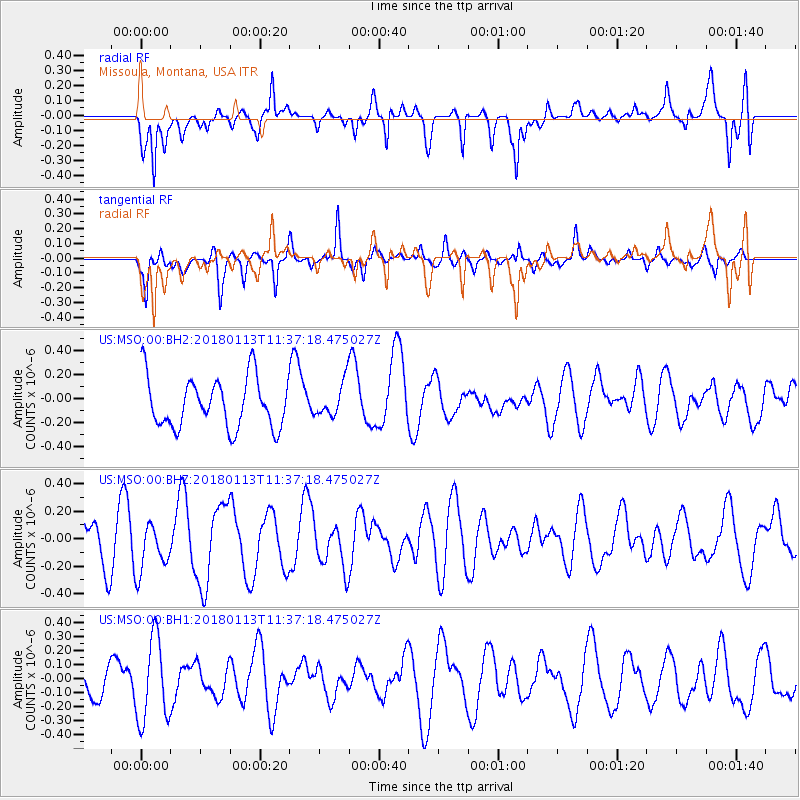
MSO Missoula, Montana, USA - Earthquake Result Viewer
*The percent match for this event was below the threshold and hence no stack was calculated.
| Earthquake location: |
Solomon Islands |
| Earthquake latitude/longitude: |
-11.2/163.0 |
| Earthquake time(UTC): |
2018/01/13 (013) 11:24:37 GMT |
| Earthquake Depth: |
24 km |
| Earthquake Magnitude: |
5.9 Mww |
| Earthquake Catalog/Contributor: |
NEIC PDE/us |
|
| Network: |
US United States National Seismic Network |
| Station: |
MSO Missoula, Montana, USA |
| Lat/Lon: |
46.83 N/113.94 W |
| Elevation: |
1264 m |
|
| Distance: |
93.4 deg |
| Az: |
43.057 deg |
| Baz: |
257.333 deg |
| Ray Param: |
$rayparam |
*The percent match for this event was below the threshold and hence was not used in the summary stack. |
|
| Radial Match: |
67.63523 % |
| Radial Bump: |
400 |
| Transverse Match: |
56.184017 % |
| Transverse Bump: |
346 |
| SOD ConfigId: |
2537251 |
| Insert Time: |
2018-01-27 11:26:11.148 +0000 |
| GWidth: |
2.5 |
| Max Bumps: |
400 |
| Tol: |
0.001 |
|
Signal To Noise
| Channel | StoN | STA | LTA |
| US:MSO:00:BHZ:20180113T11:37:18.475027Z | 0.82278204 | 1.7863726E-7 | 2.1711371E-7 |
| US:MSO:00:BH1:20180113T11:37:18.475027Z | 1.8199365 | 2.9776663E-7 | 1.6361375E-7 |
| US:MSO:00:BH2:20180113T11:37:18.475027Z | 0.68530256 | 1.4314216E-7 | 2.088744E-7 |
| Arrivals |
| Ps | |
| PpPs | |
| PsPs/PpSs | |


