You are here: Home > Network List > AV - Alaska Volcano Observatory Stations List
> Station MAPS Pakushin Southeast, Makushin Volcano, Alaska > Earthquake Result Viewer
MAPS Pakushin Southeast, Makushin Volcano, Alaska - Earthquake Result Viewer
*The percent match for this event was below the threshold and hence no stack was calculated.
| Earthquake location: |
Off Coast Of Central Mexico |
| Earthquake latitude/longitude: |
21.2/-106.1 |
| Earthquake time(UTC): |
2021/07/04 (185) 02:45:01 GMT |
| Earthquake Depth: |
46 km |
| Earthquake Magnitude: |
5.6 Mww |
| Earthquake Catalog/Contributor: |
NEIC PDE/us |
|
| Network: |
AV Alaska Volcano Observatory |
| Station: |
MAPS Pakushin Southeast, Makushin Volcano, Alaska |
| Lat/Lon: |
53.81 N/166.94 W |
| Elevation: |
333 m |
|
| Distance: |
56.0 deg |
| Az: |
321.35 deg |
| Baz: |
100.629 deg |
| Ray Param: |
$rayparam |
*The percent match for this event was below the threshold and hence was not used in the summary stack. |
|
| Radial Match: |
42.331165 % |
| Radial Bump: |
400 |
| Transverse Match: |
39.448696 % |
| Transverse Bump: |
309 |
| SOD ConfigId: |
25131211 |
| Insert Time: |
2021-07-18 02:49:50.679 +0000 |
| GWidth: |
2.5 |
| Max Bumps: |
400 |
| Tol: |
0.001 |
|
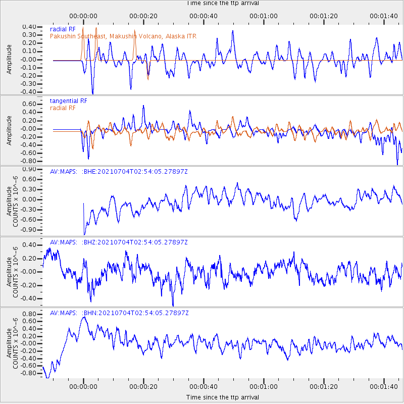
Signal To Noise
| Channel | StoN | STA | LTA |
| AV:MAPS: :BHZ:20210704T02:54:05.27897Z | 1.5463691 | 2.3688885E-7 | 1.5319037E-7 |
| AV:MAPS: :BHN:20210704T02:54:05.27897Z | 3.2364998 | 1.1359555E-6 | 3.509827E-7 |
| AV:MAPS: :BHE:20210704T02:54:05.27897Z | 1.3931534 | 3.3373803E-7 | 2.3955585E-7 |
| Arrivals |
| Ps | |
| PpPs | |
| PsPs/PpSs | |


