You are here: Home > Network List > AV - Alaska Volcano Observatory Stations List
> Station SPCR Ckakachatna River, Mount Spurr, Alaska > Earthquake Result Viewer
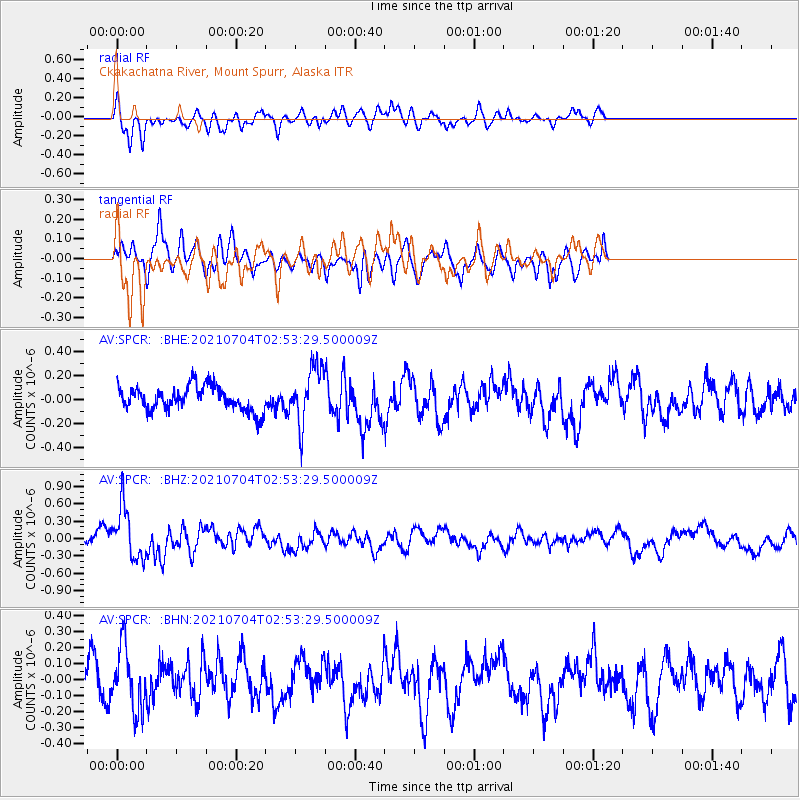
SPCR Ckakachatna River, Mount Spurr, Alaska - Earthquake Result Viewer
*The percent match for this event was below the threshold and hence no stack was calculated.
| Earthquake location: |
Off Coast Of Central Mexico |
| Earthquake latitude/longitude: |
21.2/-106.1 |
| Earthquake time(UTC): |
2021/07/04 (185) 02:45:01 GMT |
| Earthquake Depth: |
46 km |
| Earthquake Magnitude: |
5.6 Mww |
| Earthquake Catalog/Contributor: |
NEIC PDE/us |
|
| Network: |
AV Alaska Volcano Observatory |
| Station: |
SPCR Ckakachatna River, Mount Spurr, Alaska |
| Lat/Lon: |
61.20 N/152.21 W |
| Elevation: |
984 m |
|
| Distance: |
51.1 deg |
| Az: |
333.366 deg |
| Baz: |
120.232 deg |
| Ray Param: |
$rayparam |
*The percent match for this event was below the threshold and hence was not used in the summary stack. |
|
| Radial Match: |
67.76549 % |
| Radial Bump: |
400 |
| Transverse Match: |
54.13286 % |
| Transverse Bump: |
400 |
| SOD ConfigId: |
25131211 |
| Insert Time: |
2021-07-18 02:50:17.024 +0000 |
| GWidth: |
2.5 |
| Max Bumps: |
400 |
| Tol: |
0.001 |
|
Signal To Noise
| Channel | StoN | STA | LTA |
| AV:SPCR: :BHZ:20210704T02:53:29.500009Z | 4.2813096 | 4.5245307E-7 | 1.05680996E-7 |
| AV:SPCR: :BHN:20210704T02:53:29.500009Z | 2.5881622 | 1.9086765E-7 | 7.3746406E-8 |
| AV:SPCR: :BHE:20210704T02:53:29.500009Z | 2.2859535 | 2.3268387E-7 | 1.0178854E-7 |
| Arrivals |
| Ps | |
| PpPs | |
| PsPs/PpSs | |


