You are here: Home > Network List > UU - University of Utah Regional Network Stations List
> Station CCUT Cedar City, UT, USA > Earthquake Result Viewer
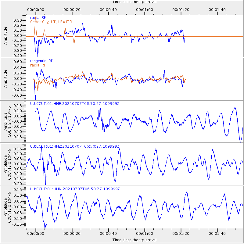
CCUT Cedar City, UT, USA - Earthquake Result Viewer
*The percent match for this event was below the threshold and hence no stack was calculated.
| Earthquake location: |
South Of Fiji Islands |
| Earthquake latitude/longitude: |
-23.2/179.6 |
| Earthquake time(UTC): |
2021/07/07 (188) 06:39:08 GMT |
| Earthquake Depth: |
536 km |
| Earthquake Magnitude: |
5.7 mww |
| Earthquake Catalog/Contributor: |
NEIC PDE/us |
|
| Network: |
UU University of Utah Regional Network |
| Station: |
CCUT Cedar City, UT, USA |
| Lat/Lon: |
37.55 N/113.36 W |
| Elevation: |
2127 m |
|
| Distance: |
87.2 deg |
| Az: |
47.091 deg |
| Baz: |
237.987 deg |
| Ray Param: |
$rayparam |
*The percent match for this event was below the threshold and hence was not used in the summary stack. |
|
| Radial Match: |
52.46875 % |
| Radial Bump: |
400 |
| Transverse Match: |
49.13285 % |
| Transverse Bump: |
400 |
| SOD ConfigId: |
25131211 |
| Insert Time: |
2021-07-21 06:53:25.867 +0000 |
| GWidth: |
2.5 |
| Max Bumps: |
400 |
| Tol: |
0.001 |
|
Signal To Noise
| Channel | StoN | STA | LTA |
| UU:CCUT:01:HHZ:20210707T06:50:27.109999Z | 1.0901899 | 7.078089E-8 | 6.492528E-8 |
| UU:CCUT:01:HHN:20210707T06:50:27.109999Z | 1.7587327 | 7.11148E-8 | 4.043525E-8 |
| UU:CCUT:01:HHE:20210707T06:50:27.109999Z | 0.69755656 | 4.563334E-8 | 6.541884E-8 |
| Arrivals |
| Ps | |
| PpPs | |
| PsPs/PpSs | |


