You are here: Home > Network List > TX - Texas Seismological Network Stations List
> Station WTFS Witchita Falls > Earthquake Result Viewer
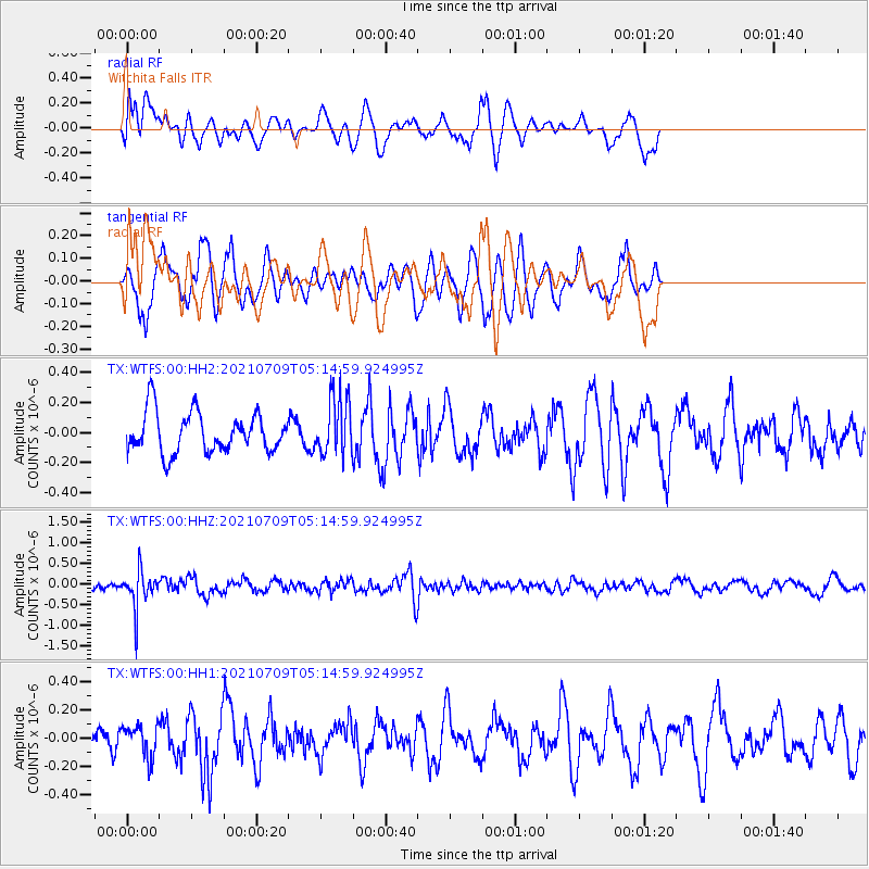
WTFS Witchita Falls - Earthquake Result Viewer
*The percent match for this event was below the threshold and hence no stack was calculated.
| Earthquake location: |
Chile-Bolivia Border Region |
| Earthquake latitude/longitude: |
-20.3/-68.7 |
| Earthquake time(UTC): |
2021/07/09 (190) 05:05:30 GMT |
| Earthquake Depth: |
114 km |
| Earthquake Magnitude: |
5.2 Mww |
| Earthquake Catalog/Contributor: |
NEIC PDE/us |
|
| Network: |
TX Texas Seismological Network |
| Station: |
WTFS Witchita Falls |
| Lat/Lon: |
33.77 N/98.46 W |
| Elevation: |
277 m |
|
| Distance: |
60.8 deg |
| Az: |
331.748 deg |
| Baz: |
147.771 deg |
| Ray Param: |
$rayparam |
*The percent match for this event was below the threshold and hence was not used in the summary stack. |
|
| Radial Match: |
66.023445 % |
| Radial Bump: |
400 |
| Transverse Match: |
63.292484 % |
| Transverse Bump: |
388 |
| SOD ConfigId: |
25131211 |
| Insert Time: |
2021-07-23 05:22:59.328 +0000 |
| GWidth: |
2.5 |
| Max Bumps: |
400 |
| Tol: |
0.001 |
|
Signal To Noise
| Channel | StoN | STA | LTA |
| TX:WTFS:00:HHZ:20210709T05:14:59.924995Z | 2.8783529 | 4.50497E-7 | 1.5651207E-7 |
| TX:WTFS:00:HH1:20210709T05:14:59.924995Z | 0.88510615 | 1.10252735E-7 | 1.2456442E-7 |
| TX:WTFS:00:HH2:20210709T05:14:59.924995Z | 1.4599291 | 1.9474996E-7 | 1.3339685E-7 |
| Arrivals |
| Ps | |
| PpPs | |
| PsPs/PpSs | |


