You are here: Home > Network List > US - United States National Seismic Network Stations List
> Station HDIL Hopedale, Illinois, USA > Earthquake Result Viewer
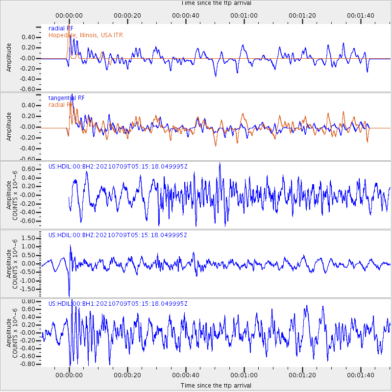
HDIL Hopedale, Illinois, USA - Earthquake Result Viewer
*The percent match for this event was below the threshold and hence no stack was calculated.
| Earthquake location: |
Chile-Bolivia Border Region |
| Earthquake latitude/longitude: |
-20.3/-68.7 |
| Earthquake time(UTC): |
2021/07/09 (190) 05:05:30 GMT |
| Earthquake Depth: |
114 km |
| Earthquake Magnitude: |
5.2 Mww |
| Earthquake Catalog/Contributor: |
NEIC PDE/us |
|
| Network: |
US United States National Seismic Network |
| Station: |
HDIL Hopedale, Illinois, USA |
| Lat/Lon: |
40.56 N/89.29 W |
| Elevation: |
219 m |
|
| Distance: |
63.5 deg |
| Az: |
342.602 deg |
| Baz: |
158.387 deg |
| Ray Param: |
$rayparam |
*The percent match for this event was below the threshold and hence was not used in the summary stack. |
|
| Radial Match: |
61.064564 % |
| Radial Bump: |
400 |
| Transverse Match: |
73.108765 % |
| Transverse Bump: |
400 |
| SOD ConfigId: |
25131211 |
| Insert Time: |
2021-07-23 05:23:43.217 +0000 |
| GWidth: |
2.5 |
| Max Bumps: |
400 |
| Tol: |
0.001 |
|
Signal To Noise
| Channel | StoN | STA | LTA |
| US:HDIL:00:BHZ:20210709T05:15:18.049995Z | 2.9467466 | 5.028752E-7 | 1.7065437E-7 |
| US:HDIL:00:BH1:20210709T05:15:18.049995Z | 2.5671453 | 4.491826E-7 | 1.7497358E-7 |
| US:HDIL:00:BH2:20210709T05:15:18.049995Z | 1.2101177 | 2.7579372E-7 | 2.2790653E-7 |
| Arrivals |
| Ps | |
| PpPs | |
| PsPs/PpSs | |


