You are here: Home > Network List > TA - USArray Transportable Network (new EarthScope stations) Stations List
> Station POKR Poker Plat Research Range, AK, USA > Earthquake Result Viewer
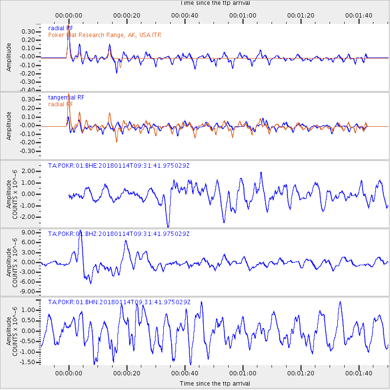
POKR Poker Plat Research Range, AK, USA - Earthquake Result Viewer
*The percent match for this event was below the threshold and hence no stack was calculated.
| Earthquake location: |
Near Coast Of Peru |
| Earthquake latitude/longitude: |
-15.8/-74.7 |
| Earthquake time(UTC): |
2018/01/14 (014) 09:18:45 GMT |
| Earthquake Depth: |
36 km |
| Earthquake Magnitude: |
7.1 mww |
| Earthquake Catalog/Contributor: |
NEIC PDE/us |
|
| Network: |
TA USArray Transportable Network (new EarthScope stations) |
| Station: |
POKR Poker Plat Research Range, AK, USA |
| Lat/Lon: |
65.12 N/147.43 W |
| Elevation: |
501 m |
|
| Distance: |
97.1 deg |
| Az: |
335.98 deg |
| Baz: |
112.135 deg |
| Ray Param: |
$rayparam |
*The percent match for this event was below the threshold and hence was not used in the summary stack. |
|
| Radial Match: |
79.04248 % |
| Radial Bump: |
400 |
| Transverse Match: |
58.181618 % |
| Transverse Bump: |
400 |
| SOD ConfigId: |
2537391 |
| Insert Time: |
2018-01-28 09:23:27.906 +0000 |
| GWidth: |
2.5 |
| Max Bumps: |
400 |
| Tol: |
0.001 |
|
Signal To Noise
| Channel | StoN | STA | LTA |
| TA:POKR:01:BHZ:20180114T09:31:41.975029Z | 7.347097 | 4.41591E-6 | 6.010415E-7 |
| TA:POKR:01:BHN:20180114T09:31:41.975029Z | 0.7483762 | 5.0028876E-7 | 6.6849907E-7 |
| TA:POKR:01:BHE:20180114T09:31:41.975029Z | 3.5293512 | 1.2659359E-6 | 3.5868797E-7 |
| Arrivals |
| Ps | |
| PpPs | |
| PsPs/PpSs | |


