You are here: Home > Network List > AV - Alaska Volcano Observatory Stations List
> Station AMKA Regional Station, Amchitka Island, Alaska > Earthquake Result Viewer
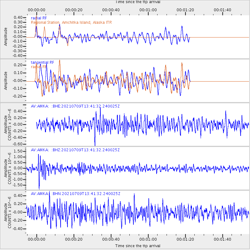
AMKA Regional Station, Amchitka Island, Alaska - Earthquake Result Viewer
*The percent match for this event was below the threshold and hence no stack was calculated.
| Earthquake location: |
Minahassa Peninsula, Sulawesi |
| Earthquake latitude/longitude: |
0.1/123.7 |
| Earthquake time(UTC): |
2021/07/09 (190) 13:31:09 GMT |
| Earthquake Depth: |
118 km |
| Earthquake Magnitude: |
5.6 mww |
| Earthquake Catalog/Contributor: |
NEIC PDE/us |
|
| Network: |
AV Alaska Volcano Observatory |
| Station: |
AMKA Regional Station, Amchitka Island, Alaska |
| Lat/Lon: |
51.38 N/179.30 E |
| Elevation: |
116 m |
|
| Distance: |
69.2 deg |
| Az: |
33.584 deg |
| Baz: |
241.958 deg |
| Ray Param: |
$rayparam |
*The percent match for this event was below the threshold and hence was not used in the summary stack. |
|
| Radial Match: |
56.703445 % |
| Radial Bump: |
400 |
| Transverse Match: |
55.74221 % |
| Transverse Bump: |
400 |
| SOD ConfigId: |
25131211 |
| Insert Time: |
2021-07-23 13:36:08.256 +0000 |
| GWidth: |
2.5 |
| Max Bumps: |
400 |
| Tol: |
0.001 |
|
Signal To Noise
| Channel | StoN | STA | LTA |
| AV:AMKA: :BHZ:20210709T13:41:32.240025Z | 5.007925 | 6.232917E-7 | 1.2446108E-7 |
| AV:AMKA: :BHN:20210709T13:41:32.240025Z | 1.410904 | 1.1684076E-7 | 8.281269E-8 |
| AV:AMKA: :BHE:20210709T13:41:32.240025Z | 2.2532046 | 2.352757E-7 | 1.04418255E-7 |
| Arrivals |
| Ps | |
| PpPs | |
| PsPs/PpSs | |


