You are here: Home > Network List > G - GEOSCOPE Stations List
> Station INU Inuyama, Japan > Earthquake Result Viewer
INU Inuyama, Japan - Earthquake Result Viewer
*The percent match for this event was below the threshold and hence no stack was calculated.
| Earthquake location: |
Minahassa Peninsula, Sulawesi |
| Earthquake latitude/longitude: |
0.1/123.7 |
| Earthquake time(UTC): |
2021/07/09 (190) 13:31:09 GMT |
| Earthquake Depth: |
118 km |
| Earthquake Magnitude: |
5.6 mww |
| Earthquake Catalog/Contributor: |
NEIC PDE/us |
|
| Network: |
G GEOSCOPE |
| Station: |
INU Inuyama, Japan |
| Lat/Lon: |
35.35 N/137.03 E |
| Elevation: |
132 m |
|
| Distance: |
37.2 deg |
| Az: |
18.134 deg |
| Baz: |
202.38 deg |
| Ray Param: |
$rayparam |
*The percent match for this event was below the threshold and hence was not used in the summary stack. |
|
| Radial Match: |
76.7311 % |
| Radial Bump: |
400 |
| Transverse Match: |
82.26905 % |
| Transverse Bump: |
400 |
| SOD ConfigId: |
25131211 |
| Insert Time: |
2021-07-23 13:38:50.791 +0000 |
| GWidth: |
2.5 |
| Max Bumps: |
400 |
| Tol: |
0.001 |
|
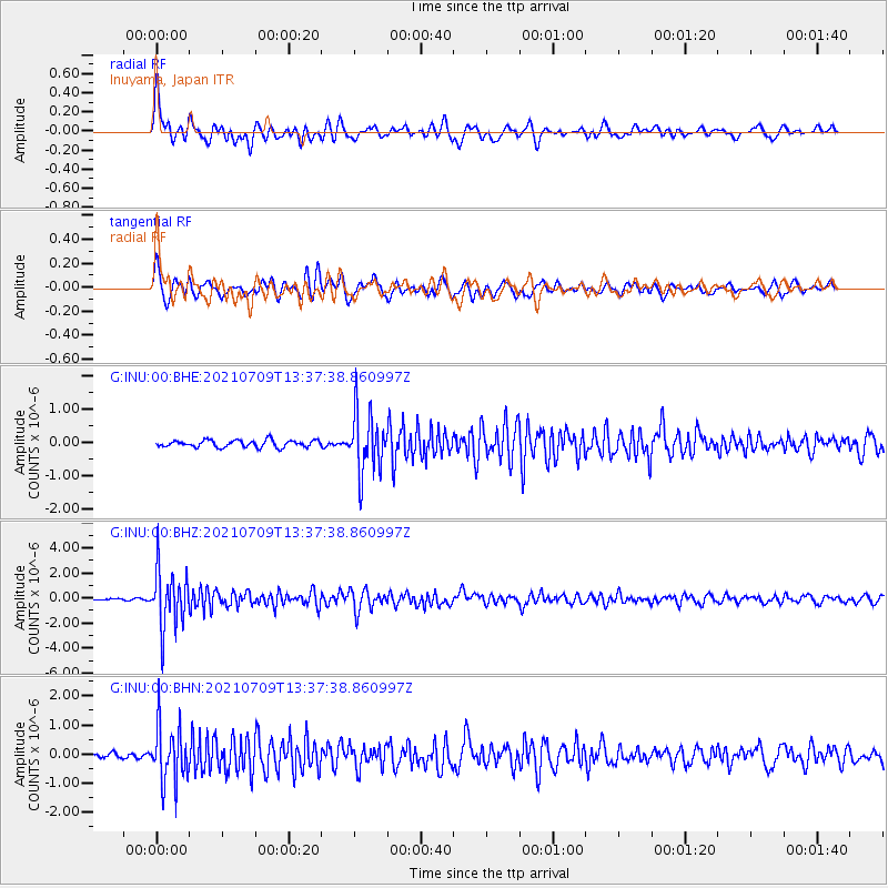
Signal To Noise
| Channel | StoN | STA | LTA |
| G:INU:00:BHZ:20210709T13:37:38.860997Z | 26.727001 | 2.2921222E-6 | 8.576055E-8 |
| G:INU:00:BHN:20210709T13:37:38.860997Z | 11.006543 | 9.912338E-7 | 9.005859E-8 |
| G:INU:00:BHE:20210709T13:37:38.860997Z | 8.765613 | 9.144158E-7 | 1.0431853E-7 |
| Arrivals |
| Ps | |
| PpPs | |
| PsPs/PpSs | |


