You are here: Home > Network List > US - United States National Seismic Network Stations List
> Station AMTX Amarillo, Texas, USA > Earthquake Result Viewer
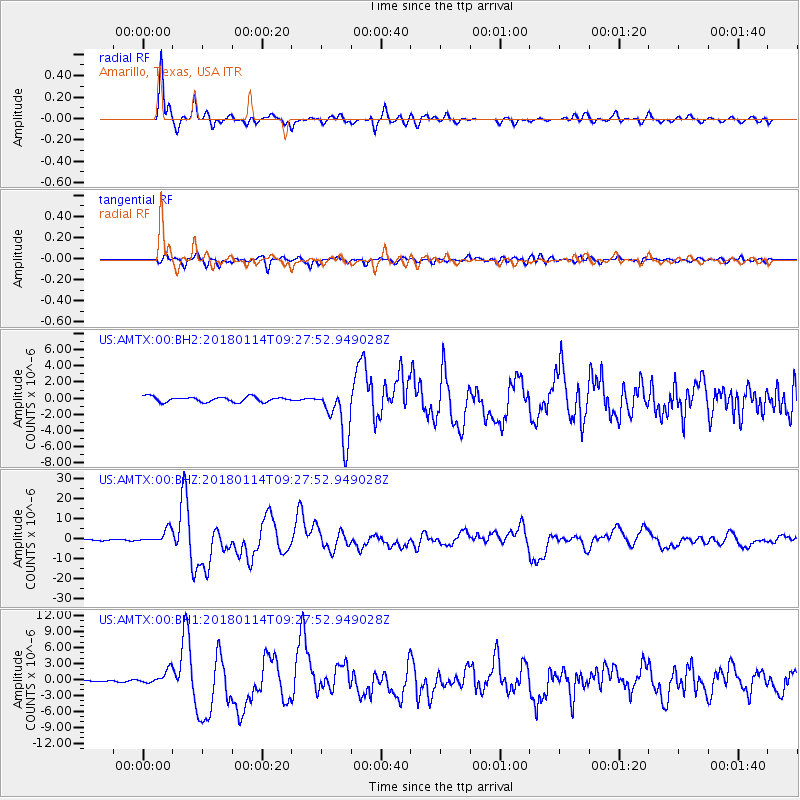
AMTX Amarillo, Texas, USA - Earthquake Result Viewer
*The percent match for this event was below the threshold and hence no stack was calculated.
| Earthquake location: |
Near Coast Of Peru |
| Earthquake latitude/longitude: |
-15.8/-74.7 |
| Earthquake time(UTC): |
2018/01/14 (014) 09:18:45 GMT |
| Earthquake Depth: |
36 km |
| Earthquake Magnitude: |
7.1 mww |
| Earthquake Catalog/Contributor: |
NEIC PDE/us |
|
| Network: |
US United States National Seismic Network |
| Station: |
AMTX Amarillo, Texas, USA |
| Lat/Lon: |
34.53 N/101.41 W |
| Elevation: |
1010 m |
|
| Distance: |
56.1 deg |
| Az: |
333.485 deg |
| Baz: |
148.626 deg |
| Ray Param: |
$rayparam |
*The percent match for this event was below the threshold and hence was not used in the summary stack. |
|
| Radial Match: |
95.895584 % |
| Radial Bump: |
361 |
| Transverse Match: |
86.135506 % |
| Transverse Bump: |
400 |
| SOD ConfigId: |
2537391 |
| Insert Time: |
2018-01-28 09:24:35.437 +0000 |
| GWidth: |
2.5 |
| Max Bumps: |
400 |
| Tol: |
0.001 |
|
Signal To Noise
| Channel | StoN | STA | LTA |
| US:AMTX:00:BHZ:20180114T09:27:52.949028Z | 10.884979 | 3.3801653E-6 | 3.1053483E-7 |
| US:AMTX:00:BH1:20180114T09:27:52.949028Z | 4.2562895 | 1.3620207E-6 | 3.200019E-7 |
| US:AMTX:00:BH2:20180114T09:27:52.949028Z | 2.5382035 | 8.5073043E-7 | 3.351703E-7 |
| Arrivals |
| Ps | |
| PpPs | |
| PsPs/PpSs | |


