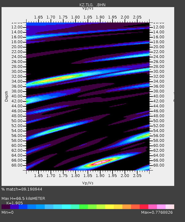
TLG Talgar, Kazakstan - Earthquake Result Viewer

Earthquake location: Kamchatka Peninsula, Russia
Earthquake latitude/longitude: 58.5/164.4
Earthquake time(UTC): 1998/04/15 (105) 15:23:06 GMT
Earthquake Depth: 33 km
Earthquake Magnitude: 5.6 MB, 5.5 MS, 6.0 UNKNOWN, 5.9 MW
Earthquake Catalog/Contributor: WHDF/NEIC
Network: KZ Kazakhstan Network
Station: TLG Talgar, Kazakstan
Lat/Lon: 43.23 N/77.22 E
Elevation: 1120 m
Distance: 53.2 deg
Az: 294.209 deg
Baz: 40.933 deg
Ray Param: 0.06621778
Estimated Moho Depth: 66.5 km
Estimated Crust Vp/Vs: 1.90
Assumed Crust Vp: 6.306 km/s
Estimated Crust Vs: 3.31 km/s
Estimated Crust Poisson's Ratio: 0.31
Radial Match: 89.198944 %
Radial Bump: 400
Transverse Match: 79.921524 %
Transverse Bump: 400
SOD ConfigId: 4480
Insert Time: 2010-03-09 10:06:47.989 +0000
GWidth: 2.5
Max Bumps: 400
Tol: 0.001

Signal To Noise

ChannelStoNSTALTA
KZ:TLG: :BHN:19980415T15:31:50.926001Z7.86918835.717732E-77.2659745E-8
KZ:TLG: :BHE:19980415T15:31:50.926001Z6.0176692.1947604E-73.6471935E-8
KZ:TLG: :BHZ:19980415T15:31:50.926001Z3.19932721.6219134E-75.069545E-8
Arrivals
Ps10 SECOND
PpPs29 SECOND
PsPs/PpSs39 SECOND