You are here: Home > Network List > AV - Alaska Volcano Observatory Stations List
> Station SPCR Ckakachatna River, Mount Spurr, Alaska > Earthquake Result Viewer
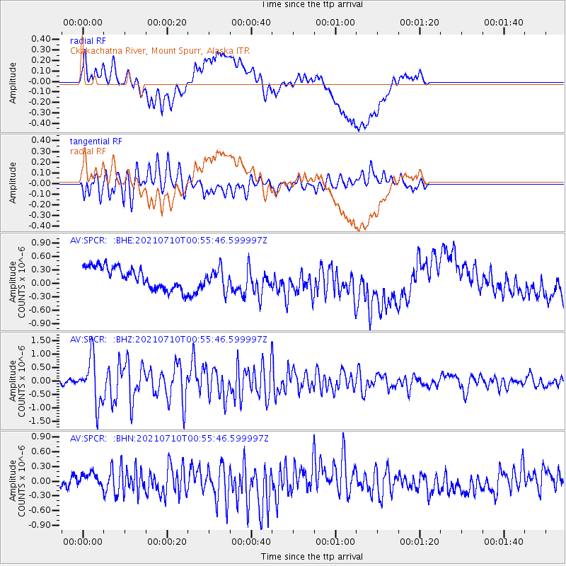
SPCR Ckakachatna River, Mount Spurr, Alaska - Earthquake Result Viewer
*The percent match for this event was below the threshold and hence no stack was calculated.
| Earthquake location: |
Northern Molucca Sea |
| Earthquake latitude/longitude: |
2.9/126.5 |
| Earthquake time(UTC): |
2021/07/10 (191) 00:43:56 GMT |
| Earthquake Depth: |
45 km |
| Earthquake Magnitude: |
6.1 Mww |
| Earthquake Catalog/Contributor: |
NEIC PDE/us |
|
| Network: |
AV Alaska Volcano Observatory |
| Station: |
SPCR Ckakachatna River, Mount Spurr, Alaska |
| Lat/Lon: |
61.20 N/152.21 W |
| Elevation: |
984 m |
|
| Distance: |
83.2 deg |
| Az: |
28.817 deg |
| Baz: |
263.781 deg |
| Ray Param: |
$rayparam |
*The percent match for this event was below the threshold and hence was not used in the summary stack. |
|
| Radial Match: |
54.51822 % |
| Radial Bump: |
400 |
| Transverse Match: |
80.069984 % |
| Transverse Bump: |
400 |
| SOD ConfigId: |
25131211 |
| Insert Time: |
2021-07-24 00:50:01.694 +0000 |
| GWidth: |
2.5 |
| Max Bumps: |
400 |
| Tol: |
0.001 |
|
Signal To Noise
| Channel | StoN | STA | LTA |
| AV:SPCR: :BHZ:20210710T00:55:46.599997Z | 10.572694 | 8.736145E-7 | 8.262932E-8 |
| AV:SPCR: :BHN:20210710T00:55:46.599997Z | 1.0536714 | 1.242915E-7 | 1.1796041E-7 |
| AV:SPCR: :BHE:20210710T00:55:46.599997Z | 0.9661752 | 2.3289509E-7 | 2.410485E-7 |
| Arrivals |
| Ps | |
| PpPs | |
| PsPs/PpSs | |


